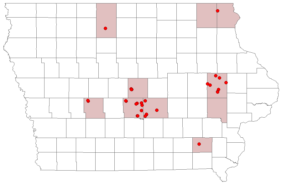
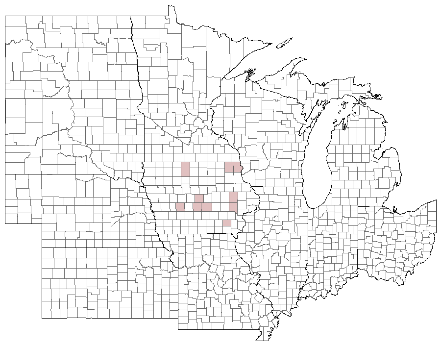
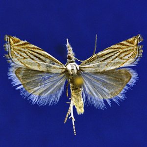
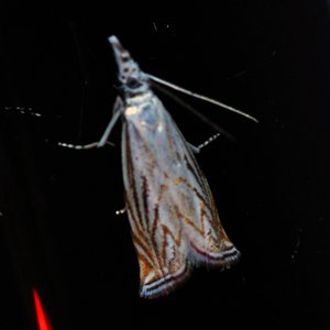
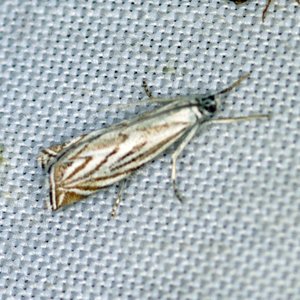
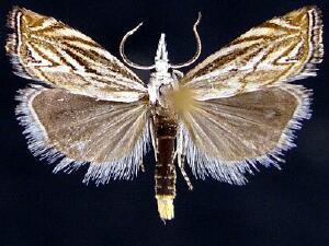
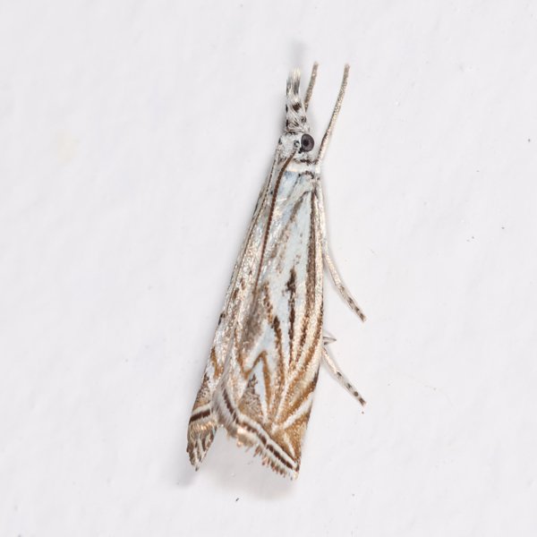
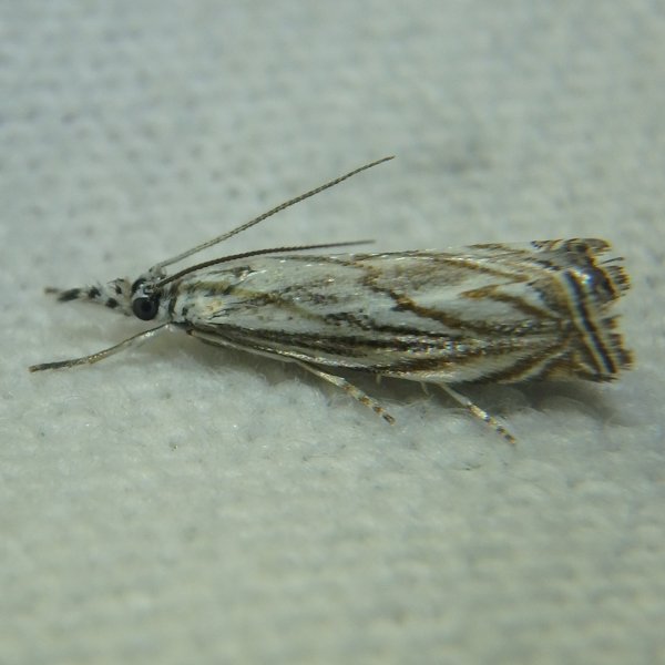
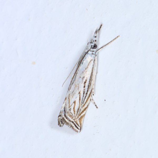
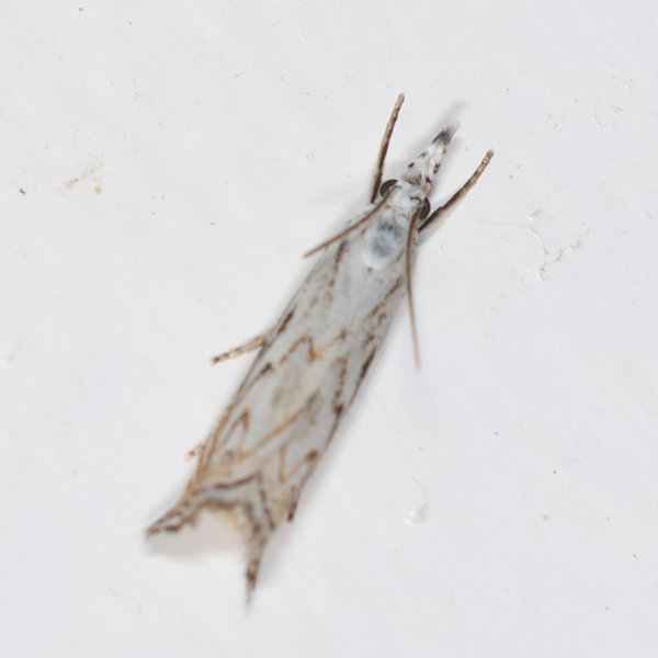
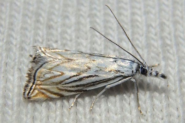
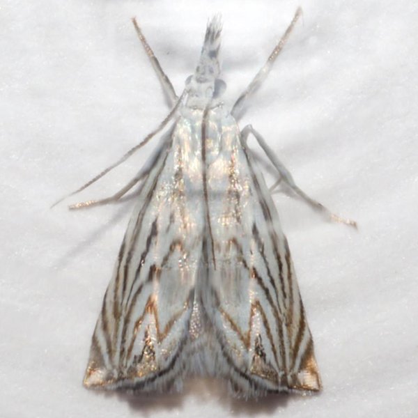
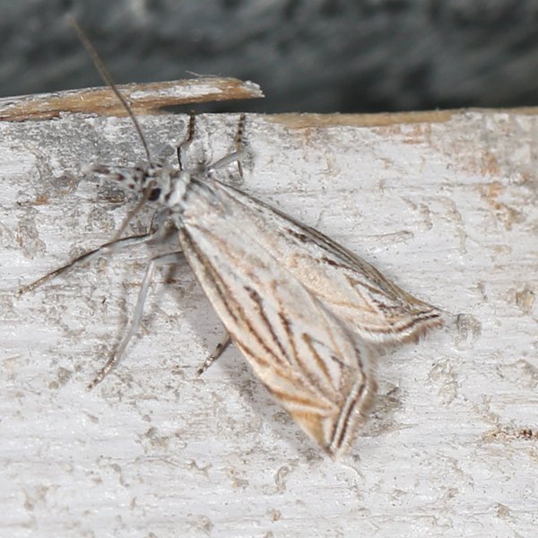
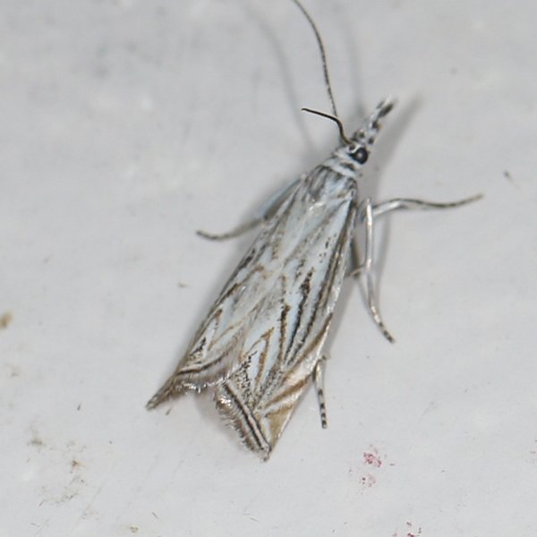
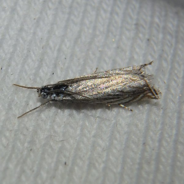
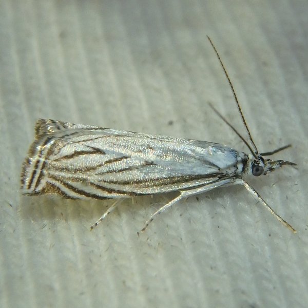
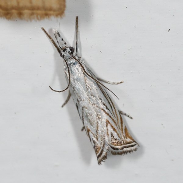
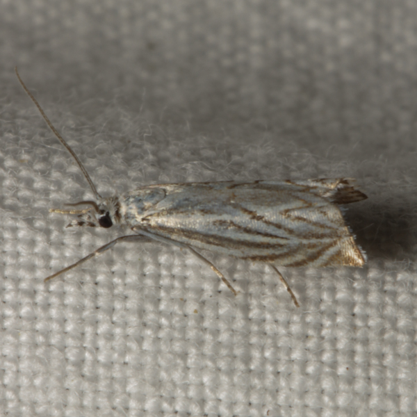
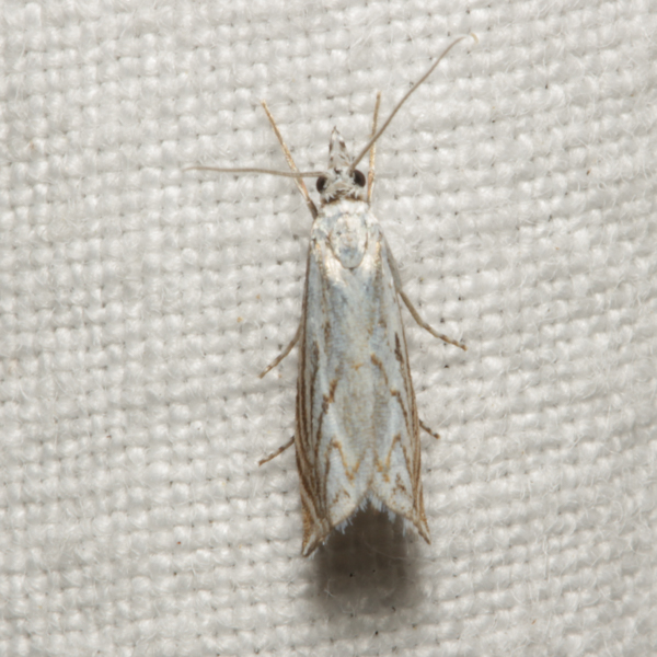
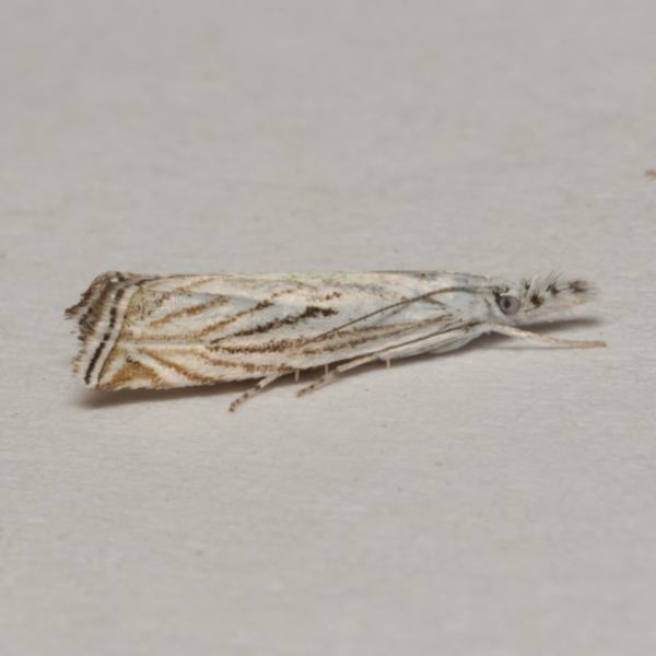
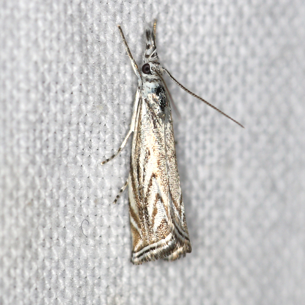
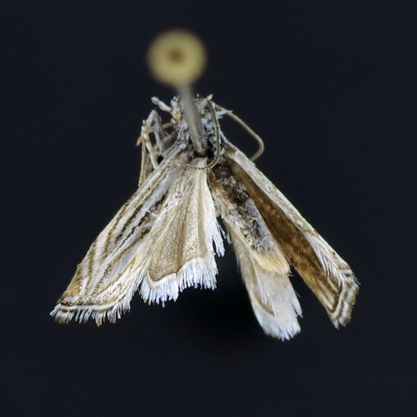
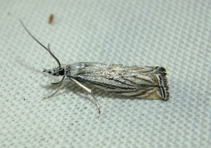
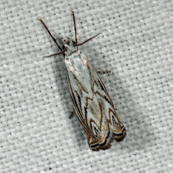
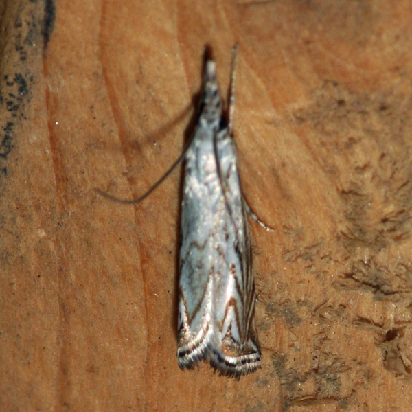
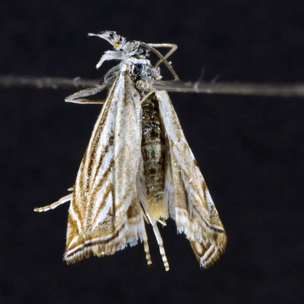
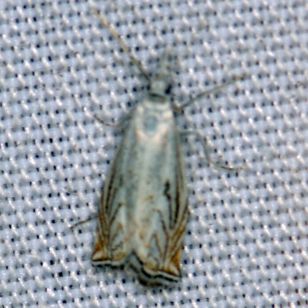
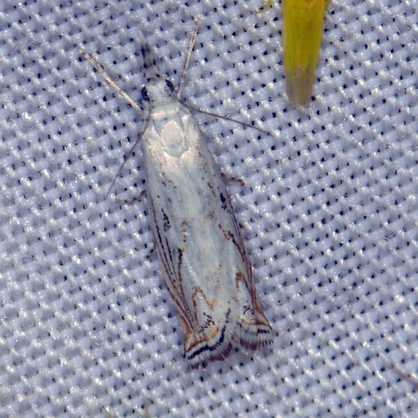
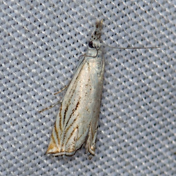
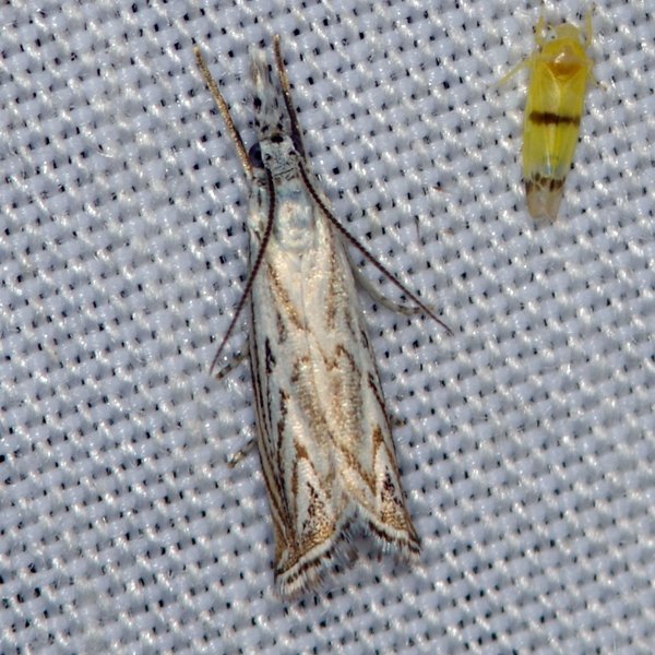
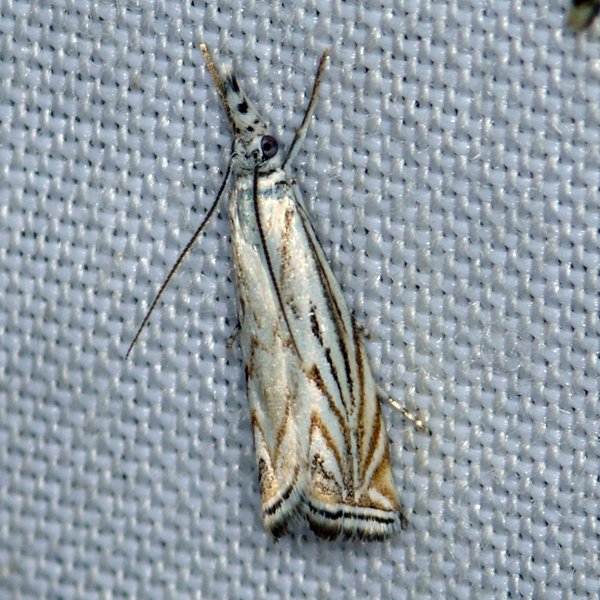
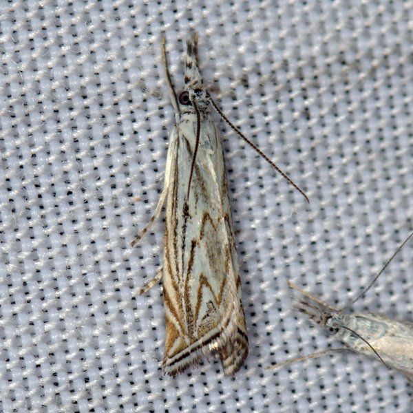
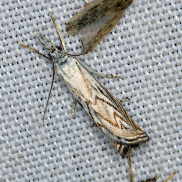
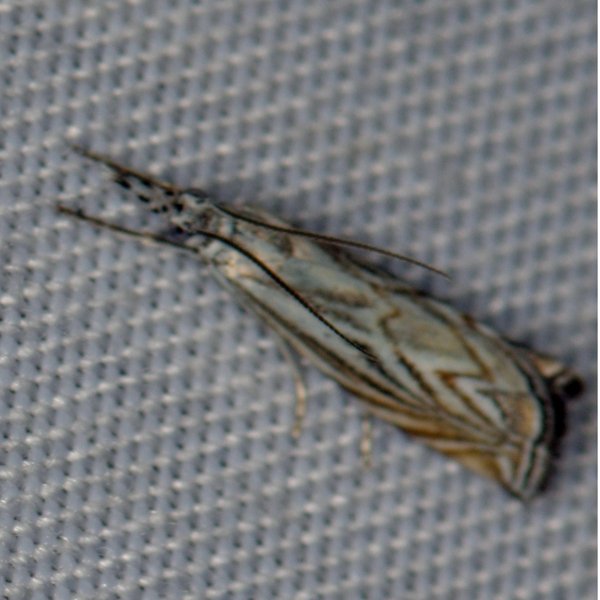
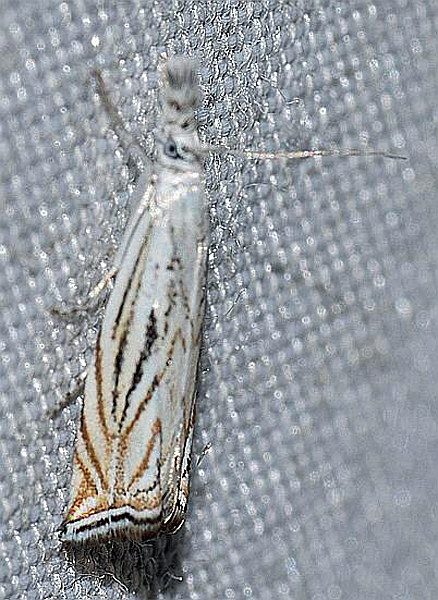
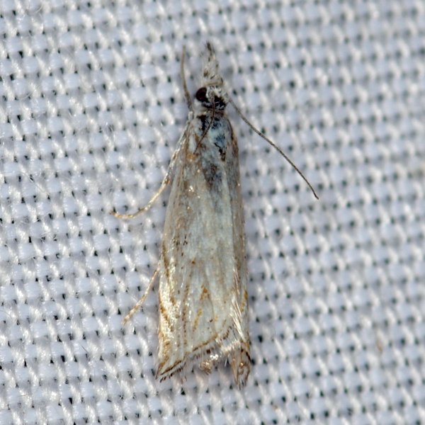
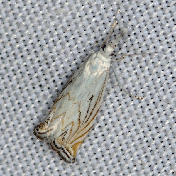
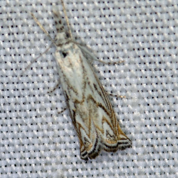
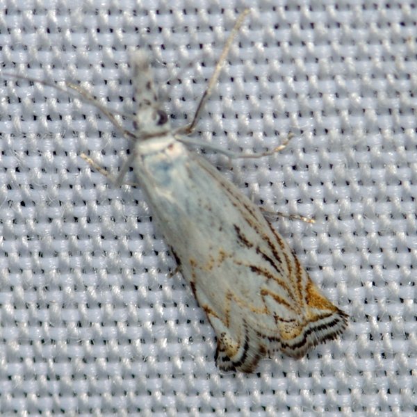
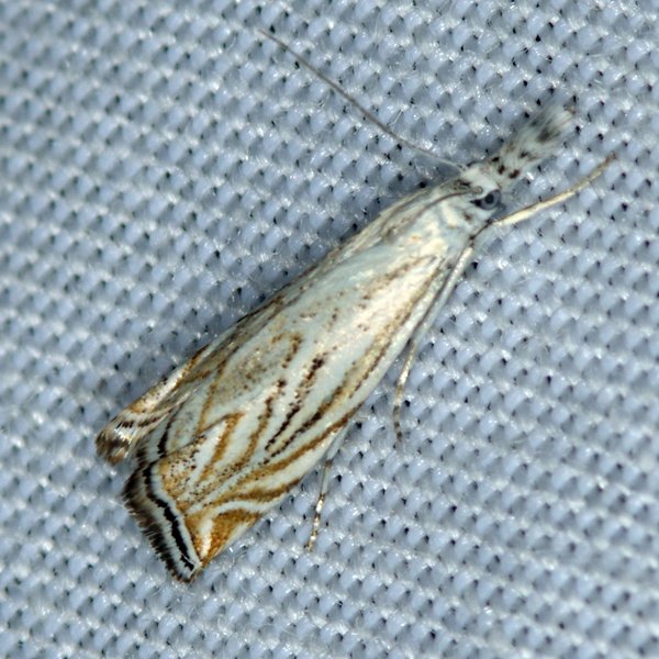
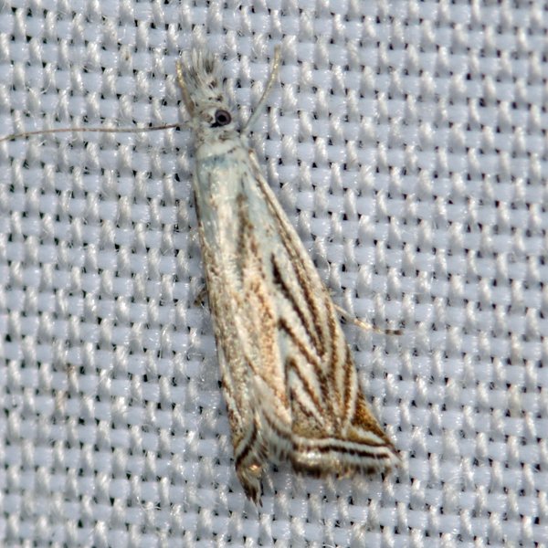
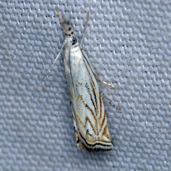
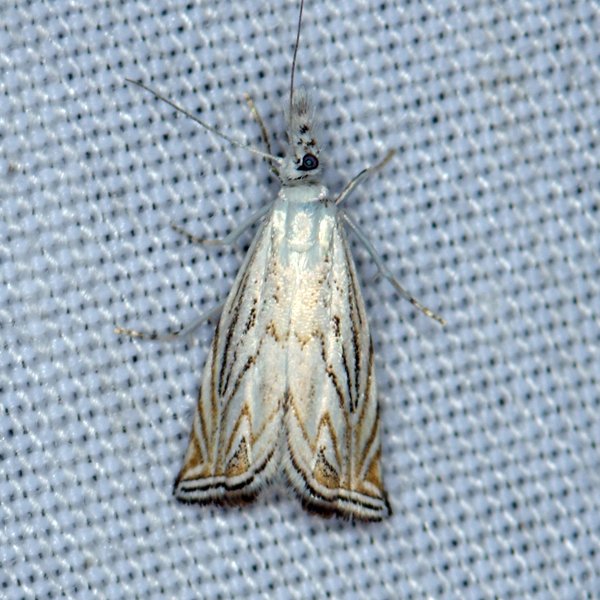
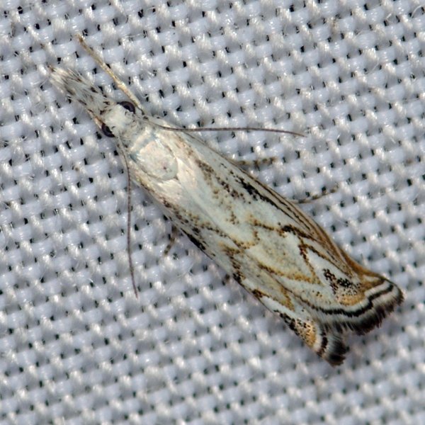
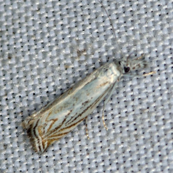
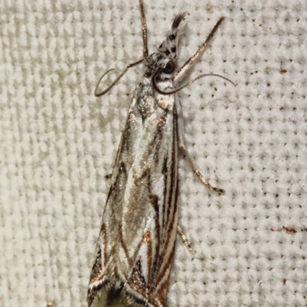
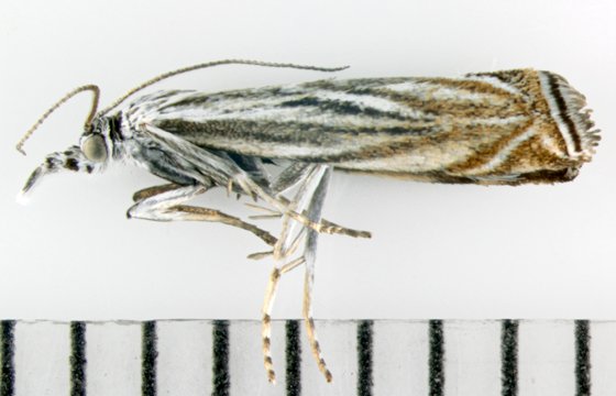
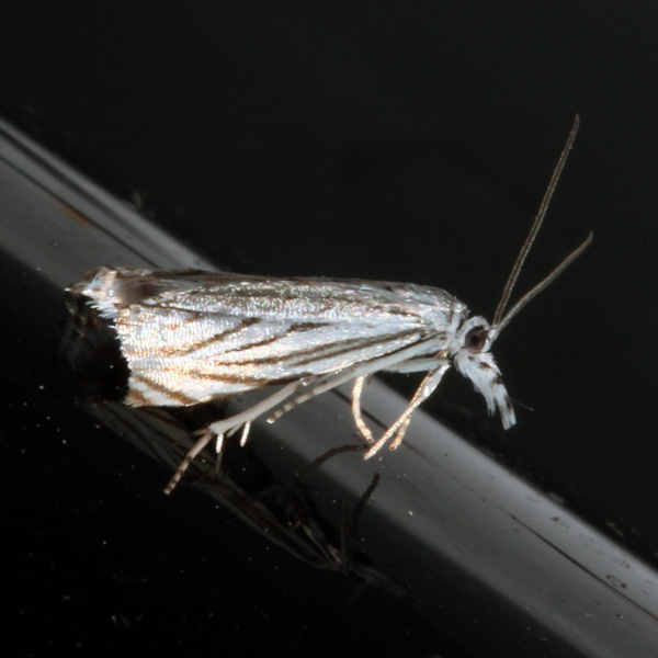
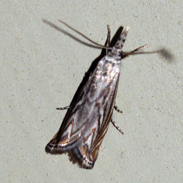
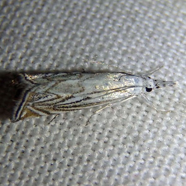
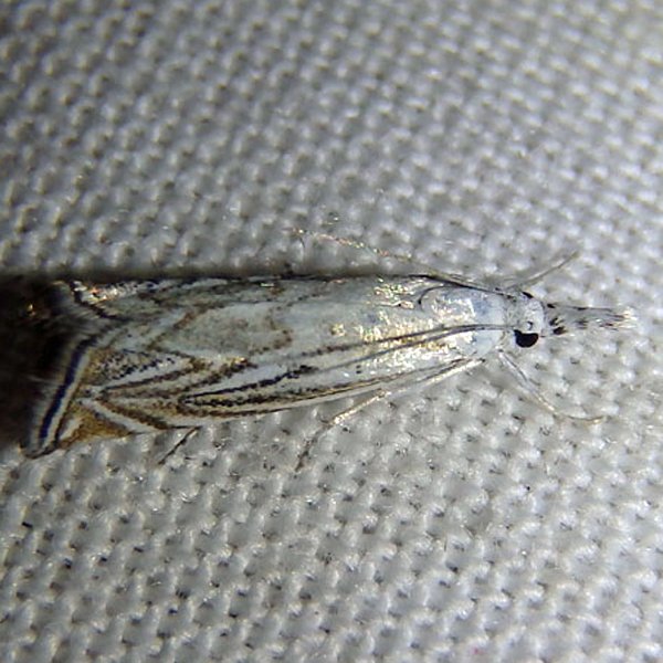
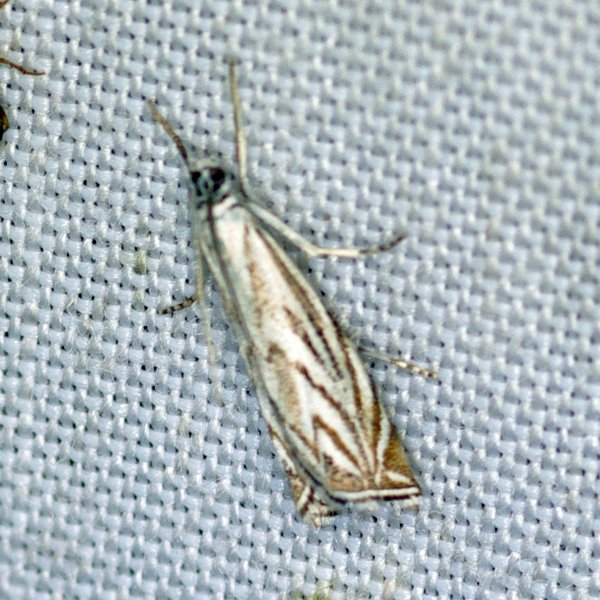
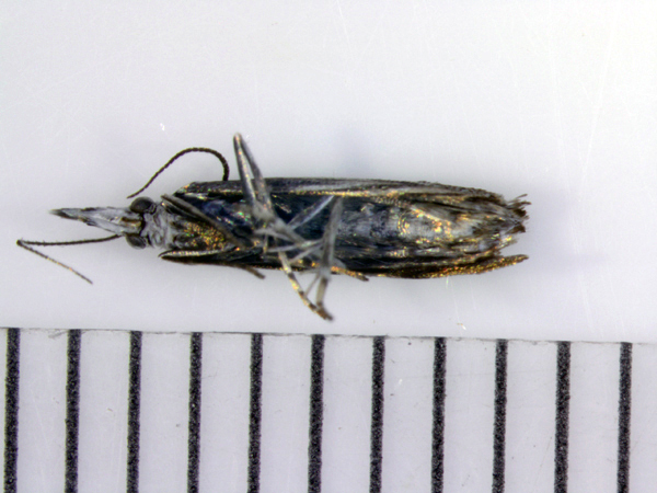
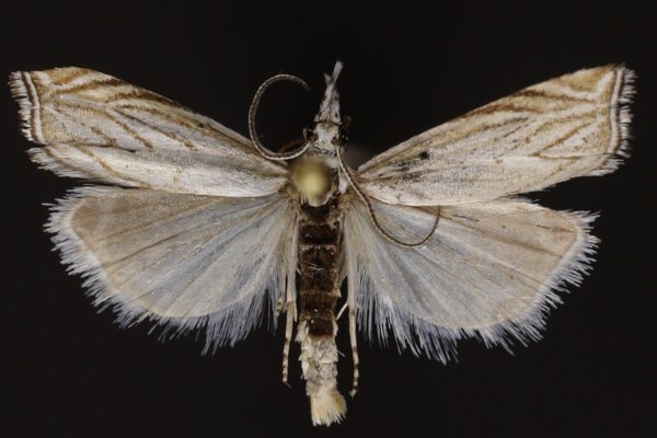
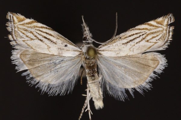
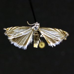
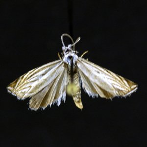
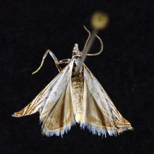
None (Platytes vobisne), Dyar, 1920 - 5394.000000 - 80a1466
Wing span: 13mm
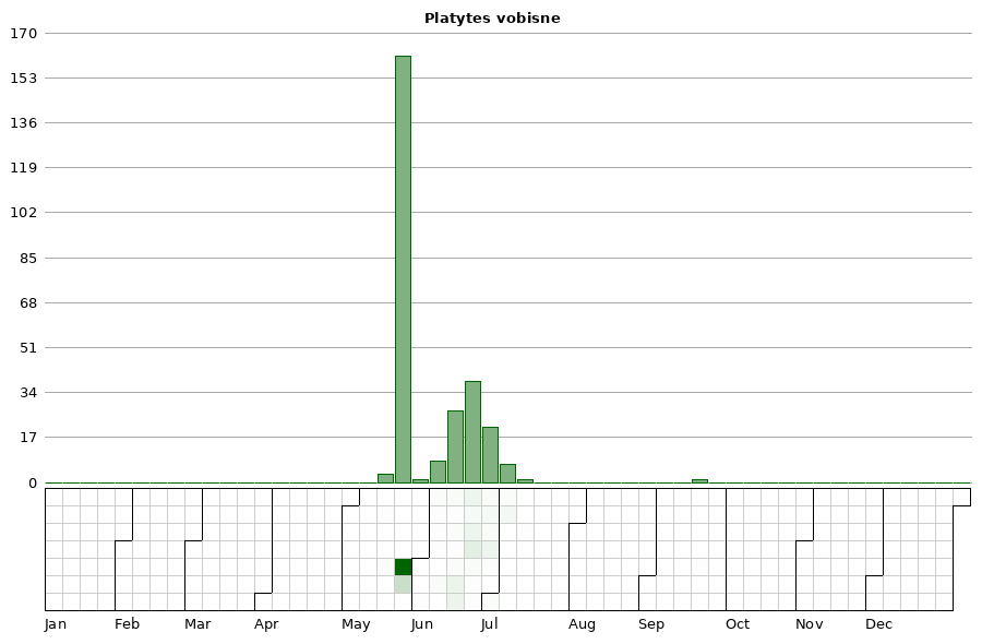
Flight time: May - September
Photos


Records
| Record # | Date | Locale | State | Lat/Lon | Collected By | Count |
|---|---|---|---|---|---|---|
 336092 336092
|
2023-06-29 | Indian Creek Nature Center | Iowa | 41.96608977 -91.58982624 | Jim Durbin | 1 |
 343293 343293
|
2023-06-26 | Johnson County, Iowa | Iowa | Location Protected | Mark Brown | 1 |
 335844 335844
|
2023-06-25 | Yellow Banks Park | Iowa | 41.548183631667 -93.473158521667 | Jim Durbin | 1 |
 335862 335862
|
2023-06-25 | Yellow Banks Park | Iowa | 41.548183631667 -93.473158521667 | Jim Durbin | 1 |
 342275 342275
|
2023-06-04 | Johnson County, Iowa | Iowa | Location Protected | Mark Brown | 1 |
 331037 331037
|
2022-07-01 | Jasper County | Iowa | 41.643989 -93.017378 | MJ Hatfield | 1 |
 311125 311125
|
2022-06-28 | Hitaga Sand Ridge Prairie Preserve | Iowa | 42.2510735 -91.63217209 | Jim Durbin | 1 |
 311158 311158
|
2022-06-28 | Hitaga Sand Ridge Prairie Preserve | Iowa | 42.2510735 -91.63217209 | Jim Durbin | 1 |
 315584 315584
|
2022-06-28 | Johnson County, Iowa | Iowa | Location Protected | Mark Brown | 1 |
 315679 315679
|
2022-06-21 | Johnson County, Iowa | Iowa | Location Protected | Mark Brown | 1 |
| 321337 | 2022-06-14 | Ames, Paul | Iowa | 42.011954 -93.615226 | Paul Martsching | 1 |
| 291077 | 2021-06-18 | Ames, Paul | Iowa | 42.009923 -93.618306 | Paul Martsching | 4 |
| 291072 | 2021-06-16 | Ames, Paul | Iowa | 42.009923 -93.618306 | Paul Martsching | 3 |
| 291076 | 2021-06-16 | Ames, Paul | Iowa | 42.009923 -93.618306 | Paul Martsching | 3 |
| 291071 | 2021-06-15 | Ames, Paul | Iowa | 42.009923 -93.618306 | Paul Martsching | 2 |
| 291070 | 2021-06-13 | Ames, Paul | Iowa | 42.009923 -93.618306 | Paul Martsching | 1 |
| 291069 | 2021-06-11 | Ames, Paul | Iowa | 42.009923 -93.618306 | Paul Martsching | 2 |
| 291068 | 2021-06-09 | Ames, Paul | Iowa | 42.009923 -93.618306 | Paul Martsching | 1 |
| 278424 | 2020-07-02 | Ames, Paul | Iowa | 42.012366 -93.613528 | Paul Martsching | 1 |
| 278423 | 2020-06-30 | Ames, Paul | Iowa | 42.012366 -93.613528 | Paul Martsching | 1 |
| 278422 | 2020-06-21 | Ames, Paul | Iowa | 42.012366 -93.613528 | Paul Martsching | 3 |
 266823 266823
|
2020-06-12 | Hitaga Sand Ridge Prairie Preserve | Iowa | 42.2508675 -91.63209427 | Jim Durbin | 1 |
| 242358 | 2019-06-28 | Ames, Paul | Iowa | 42.02064 -93.623952 | Paul Martsching | 2 |
| 242357 | 2019-06-27 | Ames, Paul | Iowa | 42.02064 -93.623952 | Paul Martsching | 1 |
 217384 217384
|
2018-07-02 | 100 Acre Wood-x | Iowa | 0 0 | MJ Hatfield | 1 |
 217387 217387
|
2018-07-02 | 100 Acre Wood-x | Iowa | 0 0 | MJ Hatfield | 1 |
 217162 217162
|
2018-06-28 | 100 Acre Wood-x | Iowa | 0 0 | MJ Hatfield | 1 |
| 226095 | 2018-06-18 | Ames, Paul | Iowa | 42.02064 -93.623952 | Paul Martsching | 1 |
 212219 212219
|
2018-06-11 | Hitaga Sand Ridge Prairie Preserve | Iowa | 42.250957 -91.632098 | Jim Durbin | 1 |
 222966 222966
|
2018-06-09 | Ames, Paul | Iowa | 42.02064 -93.623952 | Paul Martsching | 1 |
 222965 222965
|
2018-06-06 | Ames, Paul | Iowa | 42.02064 -93.623952 | Paul Martsching | 1 |
 225107 225107
|
2018-06-05 | Johnson County, Iowa | Iowa | Location Protected | Mark Brown | 1 |
 197007 197007
|
2017-07-11 | Ames, Paul | Iowa | 42.02064 -93.623952 | Paul Martsching | 1 |
 175611 175611
|
2016-06-18 | Ames, Paul | Iowa | 42.02064 -93.623952 | Paul Martsching | 1 |
| 177890 | 2016-06-16 | Ames, Paul | Iowa | 42.02064 -93.623952 | Paul Martsching | 1 |
 175612 175612
|
2016-06-15 | Ames, Paul | Iowa | 42.02064 -93.623952 | Paul Martsching | 1 |
| 131658 | 2015-07-03 | Ames, Paul | Iowa | 42.02064 -93.623952 | Paul Martsching | 1 |
| 131657 | 2015-06-28 | Ames, Paul | Iowa | 42.02064 -93.623952 | Paul Martsching | 1 |
| 131656 | 2015-06-27 | Ames, Paul | Iowa | 42.02064 -93.623952 | Paul Martsching | 1 |
| 131655 | 2015-06-21 | Ames, Paul | Iowa | 42.02064 -93.623952 | Paul Martsching | 1 |
 131654 131654
|
2015-06-20 | Ames, Paul | Iowa | 42.02064 -93.623952 | Paul Martsching | 2 |
 132516 132516
|
2015-06-20 | Ames, Paul | Iowa | 42.02064 -93.623952 | Paul Martsching | 1 |
 127143 127143
|
2015-06-19 | Indian Creek Nature Center | Iowa | 41.968932 -91.586884 | Jim Durbin | 1 |
 131653 131653
|
2015-06-18 | Ames, Paul | Iowa | 42.02064 -93.623952 | Paul Martsching | 1 |
 127037 127037
|
2015-06-16 | Wickiup Hill Outdoor Learning Area | Iowa | 42.087567 -91.767578 | Jim Durbin | 1 |
 131652 131652
|
2015-06-16 | Ames, Paul | Iowa | 42.02064 -93.623952 | Paul Martsching | 1 |
 42508 42508
|
2014-06-24 | Pleasant Creek State Recreation Area, Linn County | Iowa | 42.10948 -91.8249 | Jim Durbin | 1 |
 11964 11964
|
2014-06-21 | Whiterock Conservancy | Iowa | 41.8201 -94.64768 | Jim Durbin | 1 |
 42501 42501
|
2014-06-21 | Whiterock Conservancy | Iowa | 41.8201 -94.64768 | Jim Durbin | 1 |
 42502 42502
|
2014-06-21 | Whiterock Conservancy | Iowa | 41.8201 -94.64768 | Jim Durbin | 1 |
 42503 42503
|
2014-06-21 | Whiterock Conservancy | Iowa | 41.8201 -94.64768 | Jim Durbin | 1 |
 42504 42504
|
2014-06-21 | Whiterock Conservancy | Iowa | 41.8201 -94.64768 | Jim Durbin | 1 |
 42505 42505
|
2014-06-21 | Whiterock Conservancy | Iowa | 41.8201 -94.64768 | Jim Durbin | 1 |
 42506 42506
|
2014-06-21 | Whiterock Conservancy | Iowa | 41.8201 -94.64768 | Jim Durbin | 1 |
 42507 42507
|
2014-06-21 | Whiterock Conservancy | Iowa | 41.8201 -94.64768 | Jim Durbin | 1 |
 109545 109545
|
2014-06-21 | Whiterock Conservancy | Iowa | 41.817373 -94.645223 | Harlan Ratcliff | 1 |
 11886 11886
|
2014-06-20 | Whiterock Conservancy | Iowa | 41.8201 -94.64768 | Jim Durbin | 1 |
 42498 42498
|
2014-06-20 | Whiterock Conservancy | Iowa | 41.8201 -94.64768 | Jim Durbin | 1 |
 42499 42499
|
2014-06-20 | Whiterock Conservancy | Iowa | 41.8201 -94.64768 | Jim Durbin | 1 |
 42500 42500
|
2014-06-20 | Whiterock Conservancy | Iowa | 41.8201 -94.64768 | Jim Durbin | 1 |
 11754 11754
|
2014-06-17 | Pleasant Creek State Recreation Area, Linn County | Iowa | 42.10948 -91.8249 | Jim Durbin | 1 |
 11757 11757
|
2014-06-17 | Pleasant Creek State Recreation Area, Linn County | Iowa | 42.10948 -91.8249 | Jim Durbin | 1 |
 11784 11784
|
2014-06-17 | Pleasant Creek State Recreation Area, Linn County | Iowa | 42.10948 -91.8249 | Jim Durbin | 1 |
 11786 11786
|
2014-06-17 | Pleasant Creek State Recreation Area, Linn County | Iowa | 42.10948 -91.8249 | Jim Durbin | 1 |
 11798 11798
|
2014-06-17 | Pleasant Creek State Recreation Area, Linn County | Iowa | 42.10948 -91.8249 | Jim Durbin | 1 |
 11813 11813
|
2014-06-17 | Pleasant Creek State Recreation Area, Linn County | Iowa | 42.10948 -91.8249 | Jim Durbin | 1 |
 11862 11862
|
2014-06-17 | Pleasant Creek State Recreation Area, Linn County | Iowa | 42.10948 -91.8249 | Jim Durbin | 1 |
 42496 42496
|
2013-07-03 | 100 Acre Wood-x | Iowa | 0 0 | MJ Hatfield | 1 |
 42497 42497
|
2013-07-03 | 100 Acre Wood-x | Iowa | 0 0 | MJ Hatfield | 1 |
 146214 146214
|
2013-07-03 | 100 Acre Wood-x | Iowa | 0 0 | MJ Hatfield | 1 |
 66164 66164
|
2013-06-28 | Near Fairfield | Iowa | 41.0503 -92.024 | Moni Hayne | 1 |
| 110904 | 2013-06-27 | Polk County, Iowa | Iowa | Location Protected | Aaron Brees | 1 |
 42494 42494
|
2013-06-26 | Johnson County, Iowa | Iowa | Location Protected | Mark Brown | 1 |
 42495 42495
|
2013-06-26 | Johnson County, Iowa | Iowa | Location Protected | Mark Brown | 1 |
| 110903 | 2013-06-26 | Polk County, Iowa | Iowa | Location Protected | Aaron Brees | 1 |
| 42493 | 2013-06-25 | Algona | Iowa | 43.06998 -94.23295 | Matt Kenne | 1 |
| 110902 | 2013-06-23 | Polk County, Iowa | Iowa | Location Protected | Aaron Brees | 1 |
 42492 42492
|
2013-06-20 | Pinicon Ridge Park | Iowa | 42.21028 -91.54417 | Jim Durbin | 1 |
| 110901 | 2013-06-19 | Polk County, Iowa | Iowa | Location Protected | Aaron Brees | 1 |
 42490 42490
|
2013-06-18 | Matsell Bridge Natural Area | Iowa | 42.13131 -91.38886 | Jim Durbin | 1 |
| 110900 | 2013-06-18 | Polk County, Iowa | Iowa | Location Protected | Aaron Brees | 1 |
 42491 42491
|
2013-06-17 | Wanatee County Park | Iowa | 42.0094 -91.56623 | Tom Jantscher | 1 |
| 110899 | 2013-06-12 | Polk County, Iowa | Iowa | Location Protected | Aaron Brees | 1 |
 67543 67543
|
2012-06-18 | 100 Acre Wood-x | Iowa | 0 0 | MJ Hatfield | 1 |
 42488 42488
|
2012-06-08 | Whiterock Conservancy | Iowa | 41.80725 -94.64085 | Jim Durbin | 1 |
 42487 42487
|
2012-06-02 | Ashton-Wildwood County Park | Iowa | 41.81153 -93.29551 | Jim Durbin | 1 |
| 42485 | 2011-05-18 | Puccoon Prairie | Iowa | 41.73528 -93.36417 | Keith Summerville | 1 |
| 42486 | 2011-05-18 | Chichaqua Bottoms Sandhill Prairie | Iowa | 41.77278 -93.385 | Keith Summerville | 1 |
 42483 42483
|
2009-09-21 | Heritage Valley | Iowa | 43.37455 -91.589809 | MJ Hatfield | 1 |
 42484 42484
|
2009-06-21 | Heritage Valley | Iowa | 43.37455 -91.589809 | MJ Hatfield | 1 |
 133589 133589
|
2006-06-21 | Ames, Paul | Iowa | 42.02064 -93.623952 | Paul Martsching | 1 |
 133587 133587
|
2006-06-07 | Ames, Paul | Iowa | 42.02064 -93.623952 | Paul Martsching | 1 |
 133588 133588
|
2006-06-04 | Ames, Paul | Iowa | 42.02064 -93.623952 | Paul Martsching | 1 |
| 42480 | 2006-05-25 | Neal Smith National Wildlife Refuge | Iowa | 41.54245 -93.2908 | Keith Summerville | 1 |
| 71216 | 2006-05-25 | Thomas Mitchell Park | Iowa | 41.64 -93.3823 | Keith Summerville | 1 |
| 71218 | 2006-05-25 | Puccoon Prairie | Iowa | 41.73528 -93.36417 | Keith Summerville | 1 |
| 71221 | 2006-05-25 | Synder Farm INHF | Iowa | 41.76675 -93.484171 | Keith Summerville | 4 |
| 71223 | 2006-05-25 | Chichaqua Bottoms Sandhill Prairie | Iowa | 41.77278 -93.385 | Keith Summerville | 6 |
| 71225 | 2006-05-25 | Paul Errington Marsh Wildlife Management Area | Iowa | 41.75611 -93.50556 | Keith Summerville | 2 |
| 71228 | 2006-05-25 | Neal Smith National Wildlife Refuge | Iowa | 41.57639 -93.265 | Keith Summerville | 21 |
| 71231 | 2006-05-25 | Yellow Banks Park | Iowa | 41.547615 -93.47527 | Keith Summerville | 1 |
| 71234 | 2006-05-25 | Neal Smith National Wildlife Refuge | Iowa | 41.54245 -93.2908 | Keith Summerville | 55 |
| 42481 | 2005-05-25 | Neal Smith National Wildlife Refuge | Iowa | 41.54245 -93.2908 | Keith Summerville | 1 |
| 71213 | 2005-05-25 | Big Creek State Park | Iowa | 41.807055 -93.745185 | Keith Summerville | 4 |
| 71215 | 2005-05-25 | Thomas Mitchell Park | Iowa | 41.64 -93.3823 | Keith Summerville | 7 |
| 71217 | 2005-05-25 | Puccoon Prairie | Iowa | 41.73528 -93.36417 | Keith Summerville | 5 |
| 71220 | 2005-05-25 | Synder Farm INHF | Iowa | 41.76675 -93.484171 | Keith Summerville | 2 |
| 71222 | 2005-05-25 | Chichaqua Bottoms Sandhill Prairie | Iowa | 41.77278 -93.385 | Keith Summerville | 7 |
| 71224 | 2005-05-25 | Paul Errington Marsh Wildlife Management Area | Iowa | 41.75611 -93.50556 | Keith Summerville | 1 |
| 71227 | 2005-05-25 | Neal Smith National Wildlife Refuge | Iowa | 41.57639 -93.265 | Keith Summerville | 10 |
| 71230 | 2005-05-25 | Big Creek State Park | Iowa | 41.81167 -93.75333 | Keith Summerville | 1 |
| 71233 | 2005-05-25 | Neal Smith National Wildlife Refuge | Iowa | 41.54245 -93.2908 | Keith Summerville | 4 |
| 42482 | 2004-05-25 | Neal Smith National Wildlife Refuge | Iowa | 41.54245 -93.2908 | Keith Summerville | 1 |
| 71214 | 2004-05-25 | Thomas Mitchell Park | Iowa | 41.64 -93.3823 | Keith Summerville | 4 |
| 71219 | 2004-05-25 | Synder Farm INHF | Iowa | 41.76675 -93.484171 | Keith Summerville | 2 |
| 71226 | 2004-05-25 | Neal Smith National Wildlife Refuge | Iowa | 41.57639 -93.265 | Keith Summerville | 15 |
| 71229 | 2004-05-25 | Big Creek State Park | Iowa | 41.81167 -93.75333 | Keith Summerville | 3 |
| 71232 | 2004-05-25 | Neal Smith National Wildlife Refuge | Iowa | 41.54245 -93.2908 | Keith Summerville | 2 |
| 42479 | 2003-05-15 | Neal Smith National Wildlife Refuge | Iowa | 41.5678 -93.2675 | Keith Summerville | 1 |