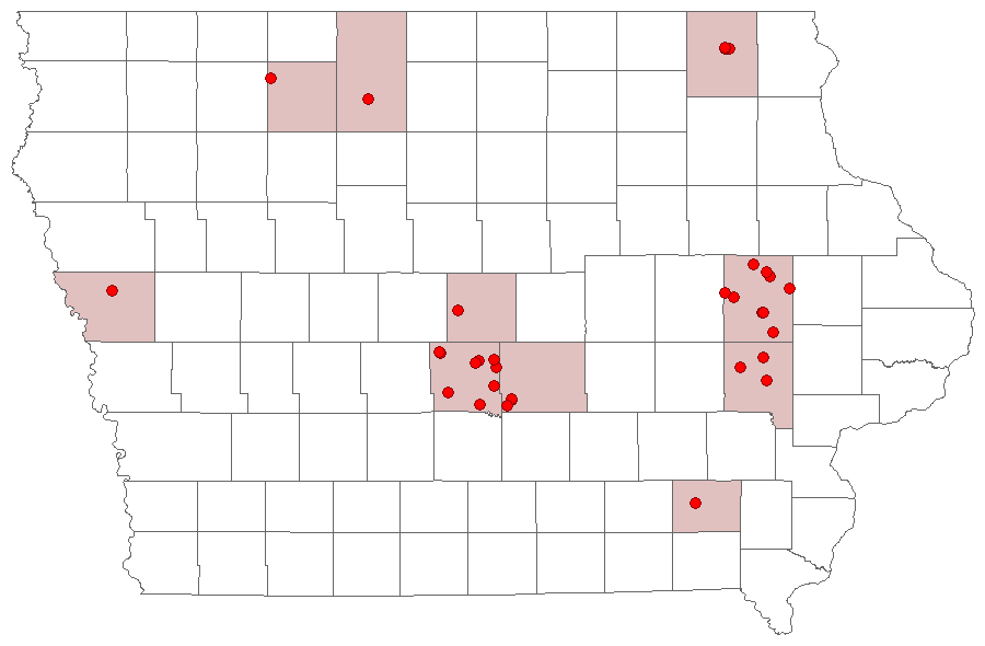
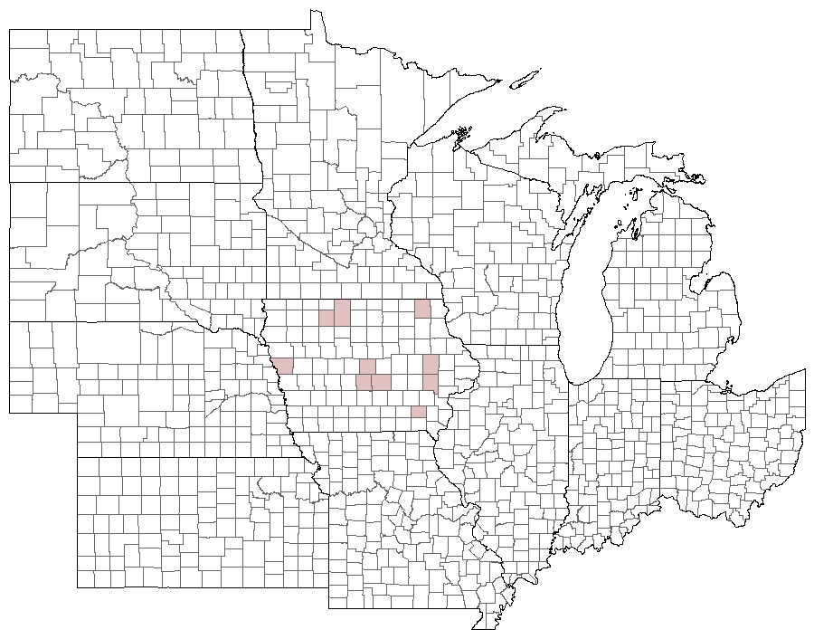
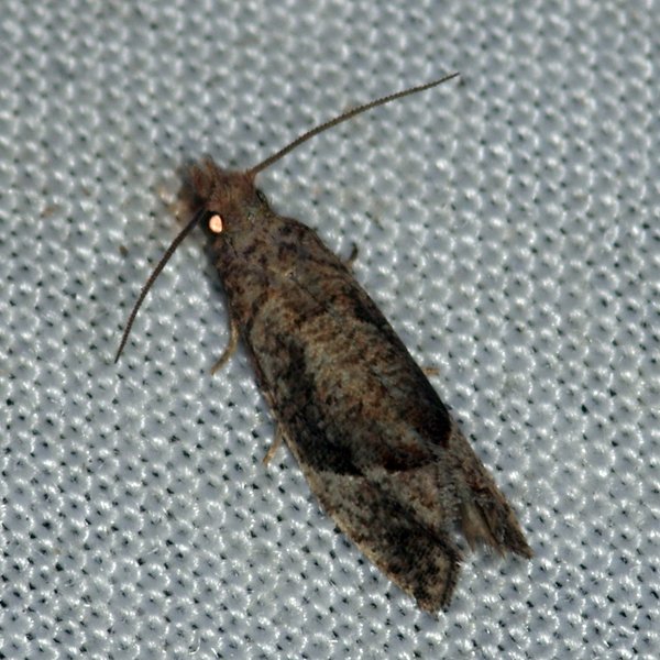
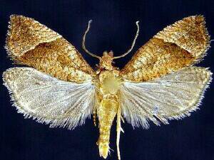
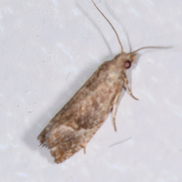
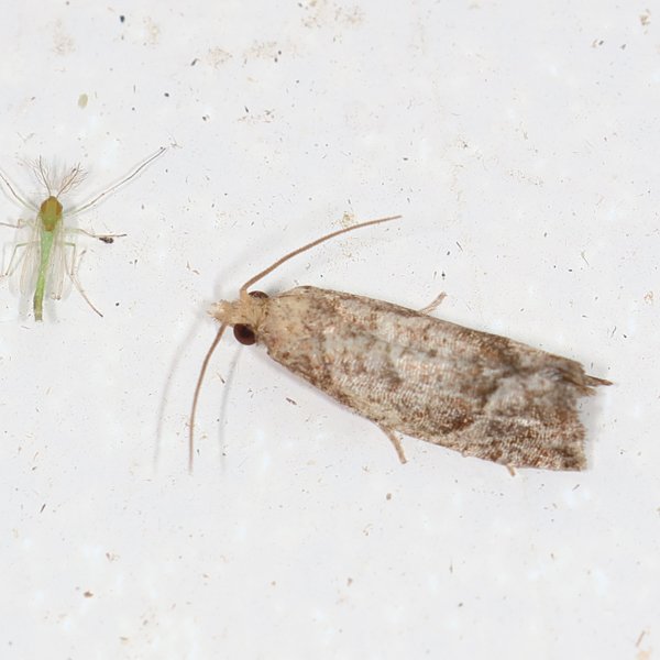
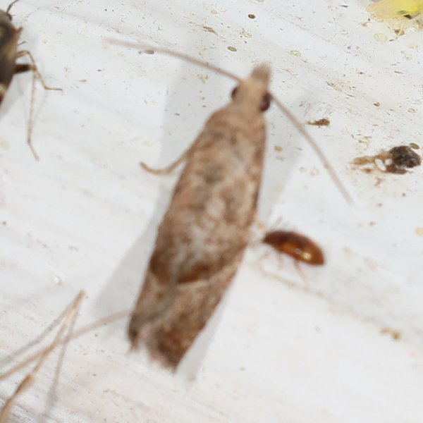
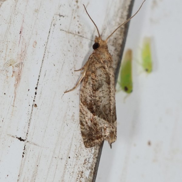
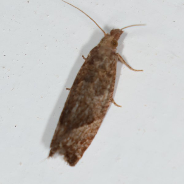
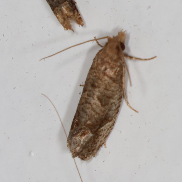
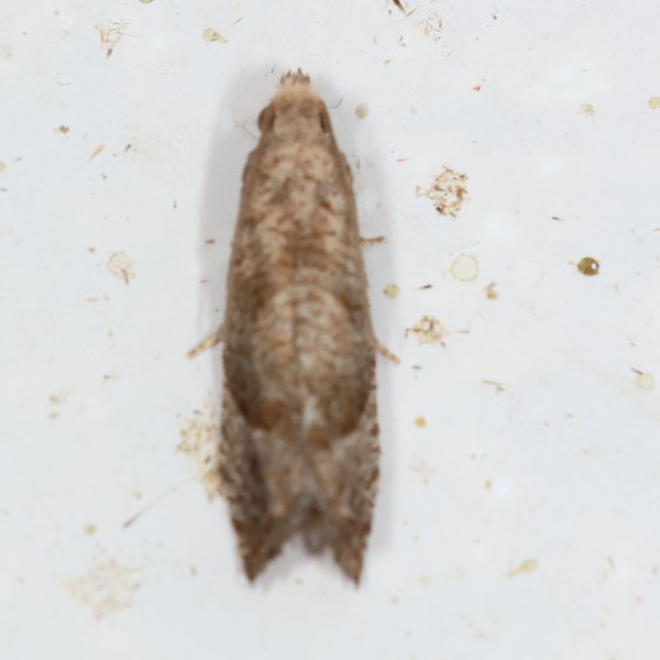
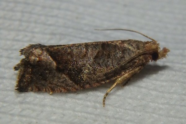
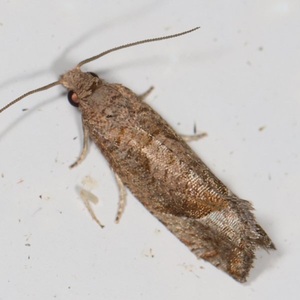
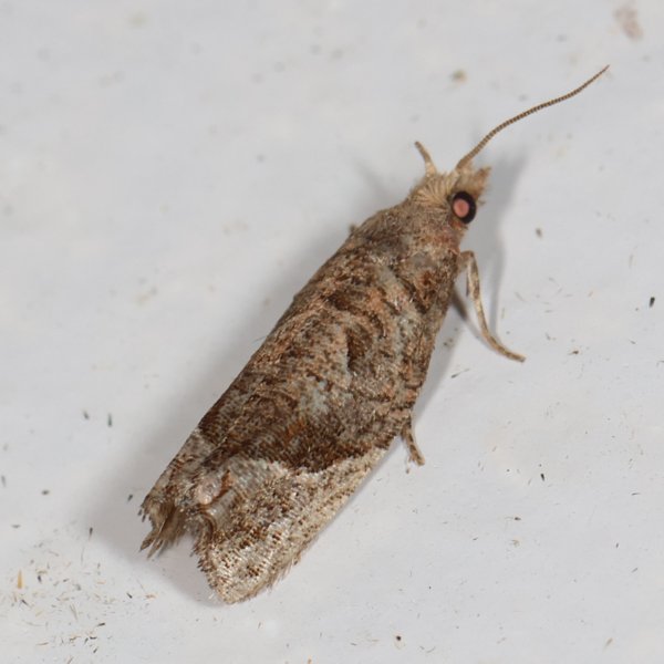
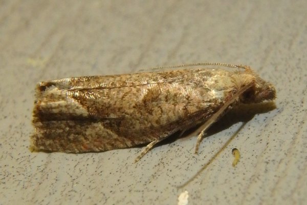
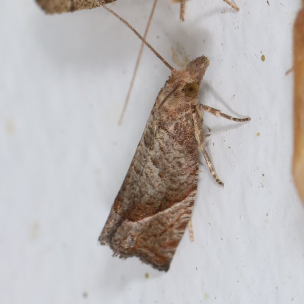
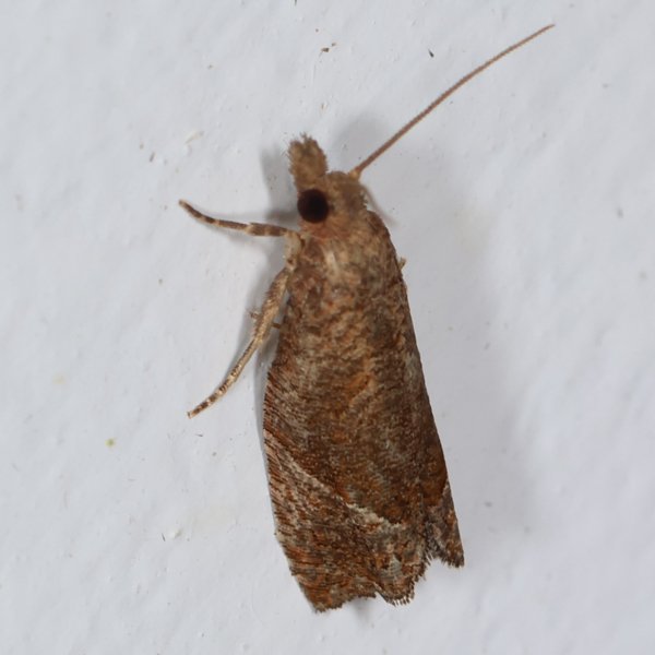
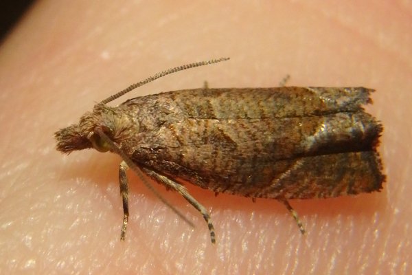
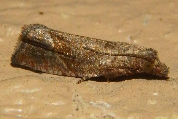
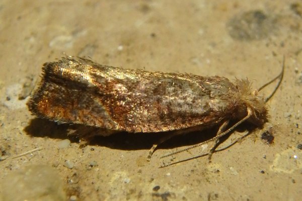
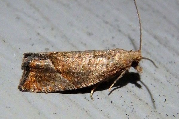
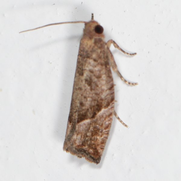
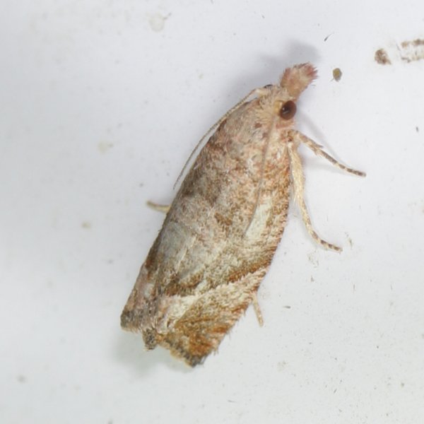
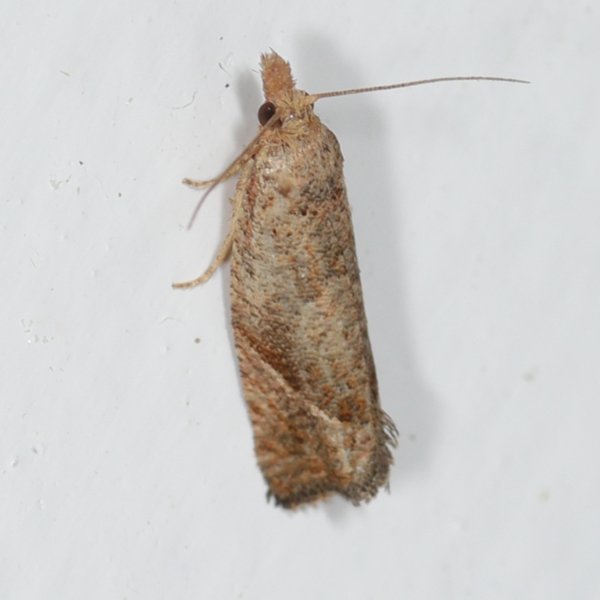
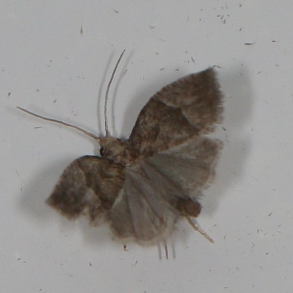
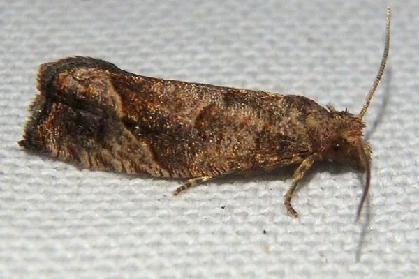
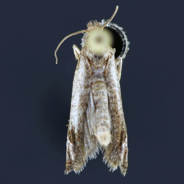
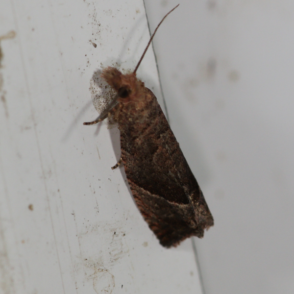
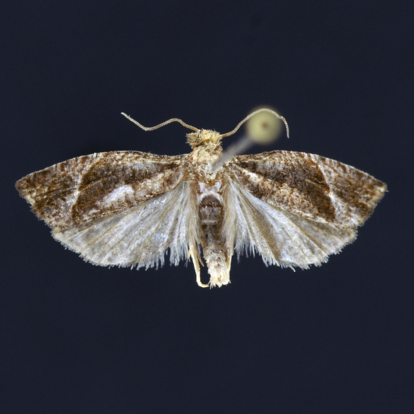
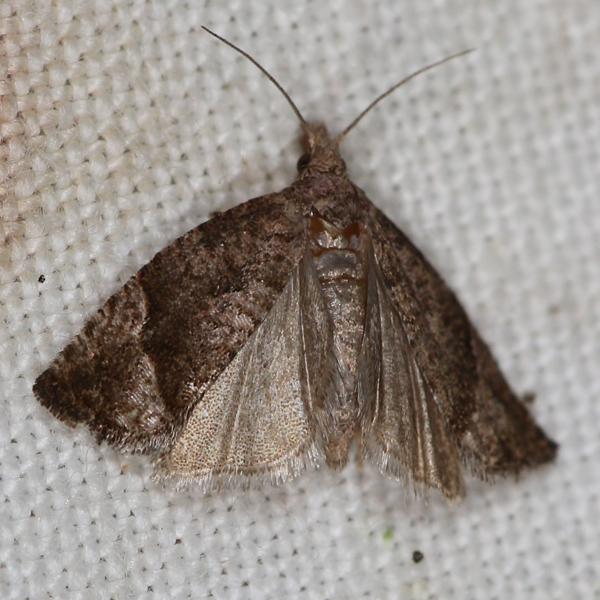
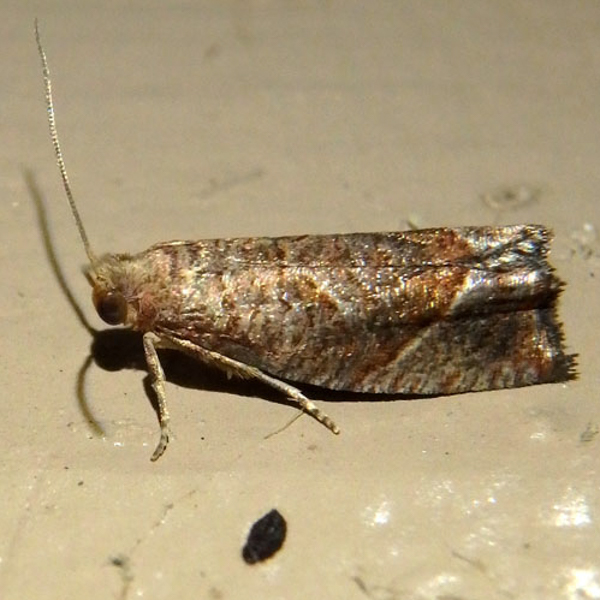
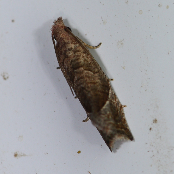
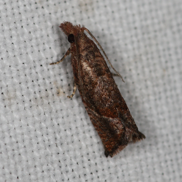
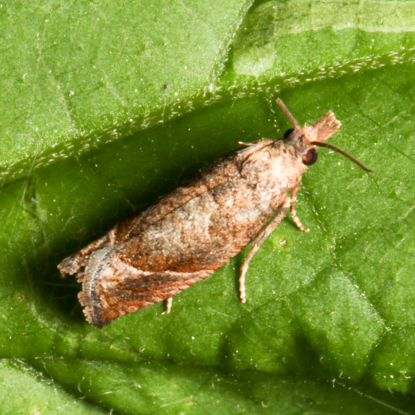
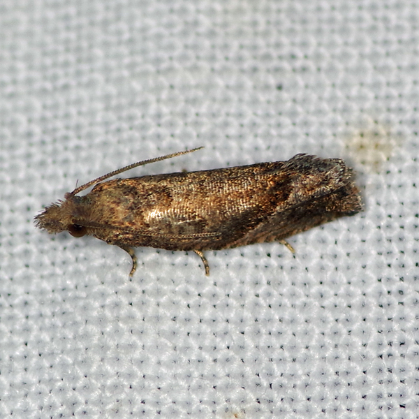
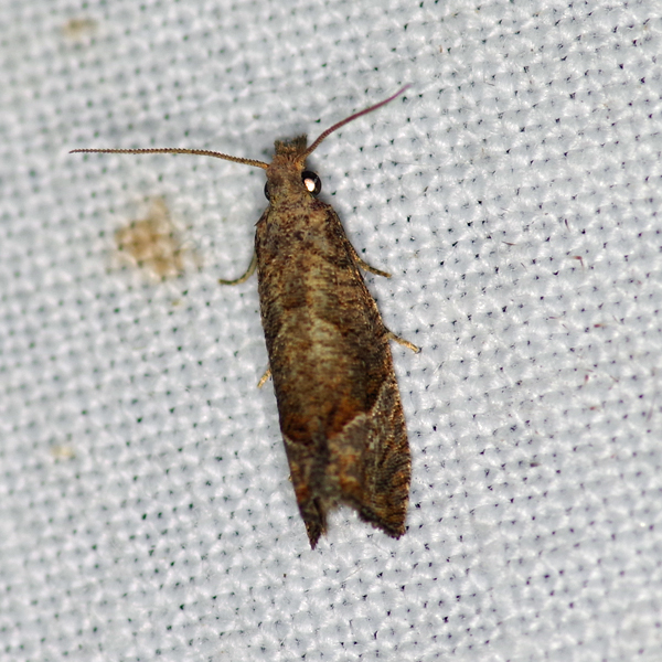
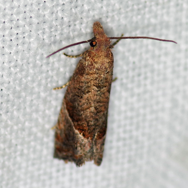
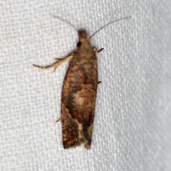
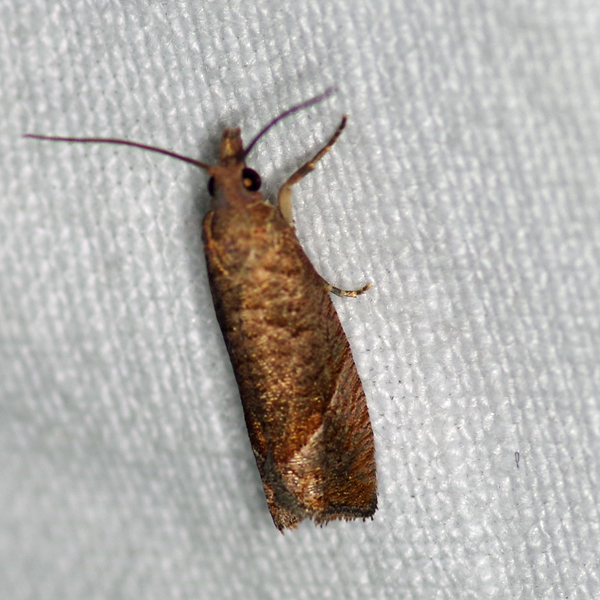
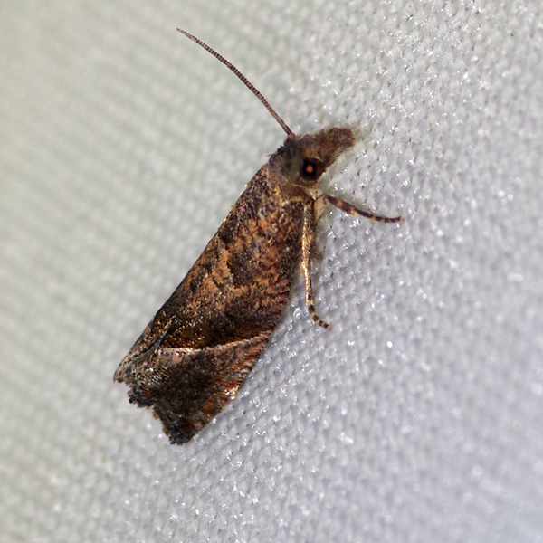
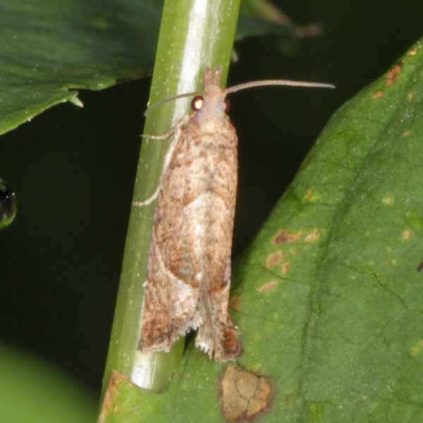
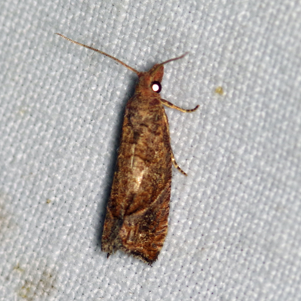
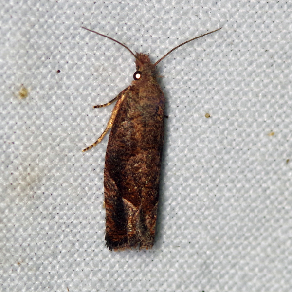
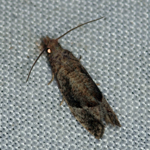
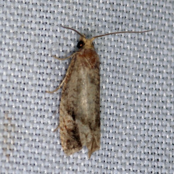
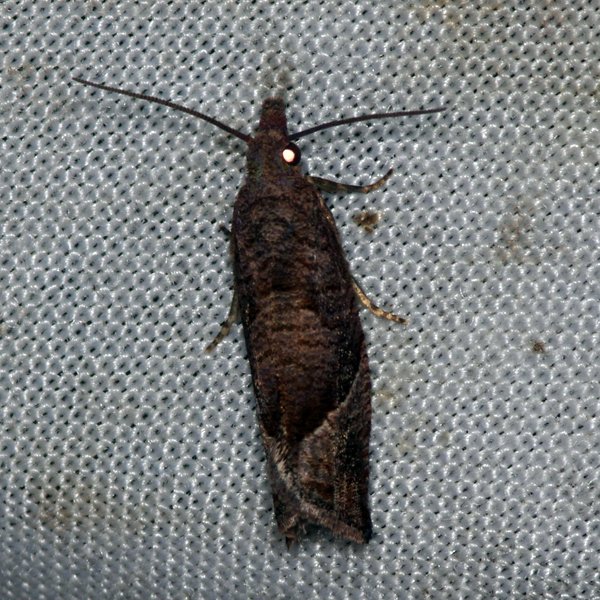
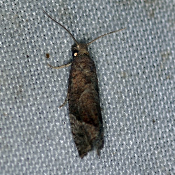
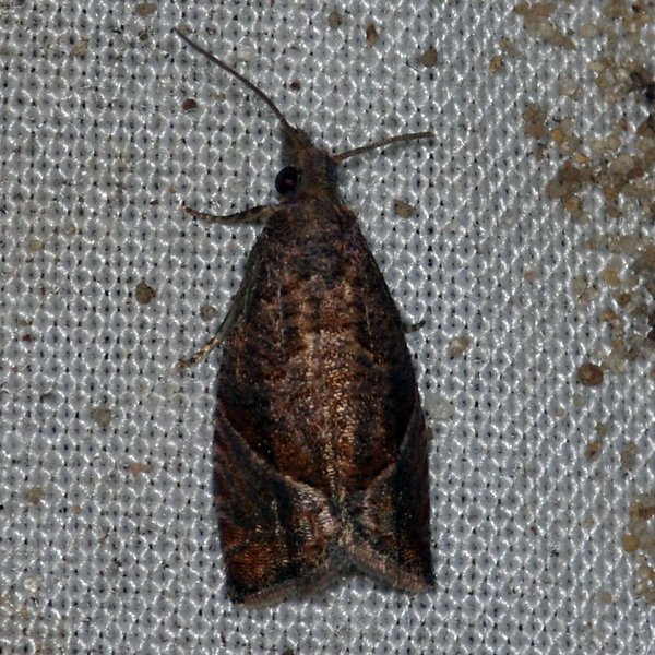
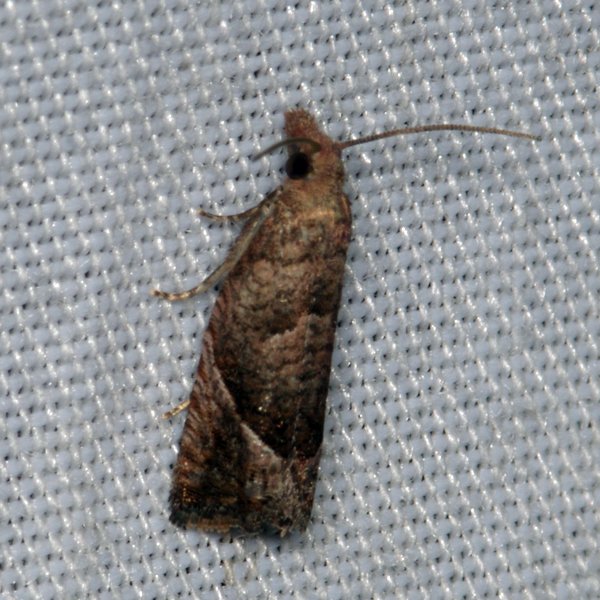
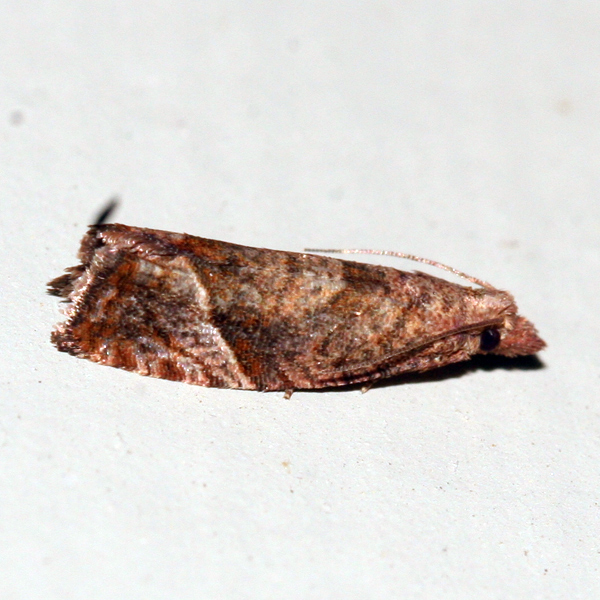
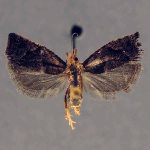
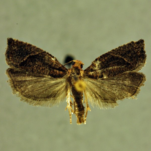
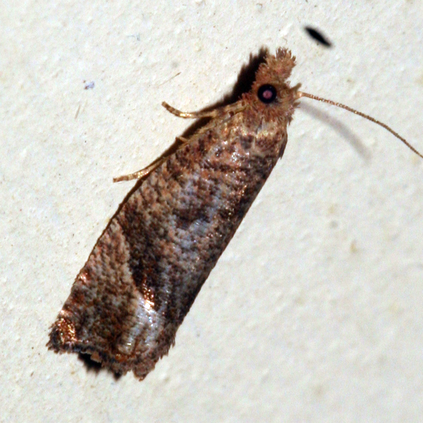
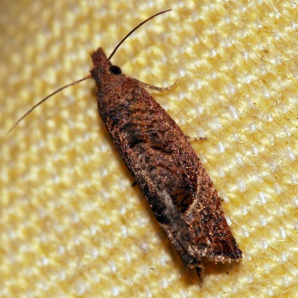
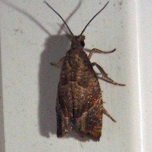
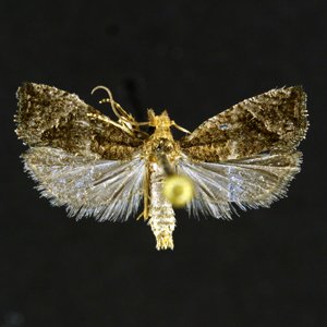
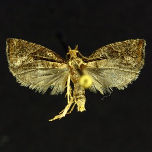
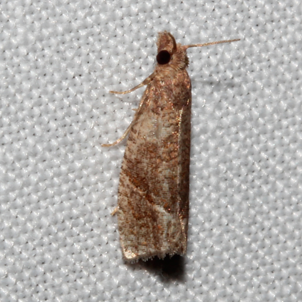
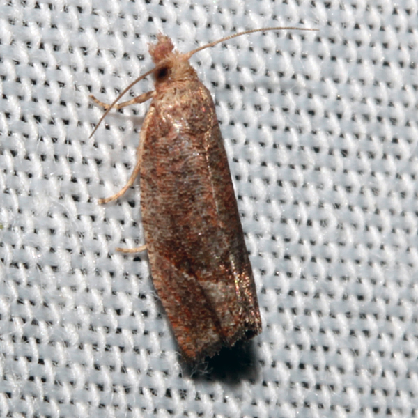
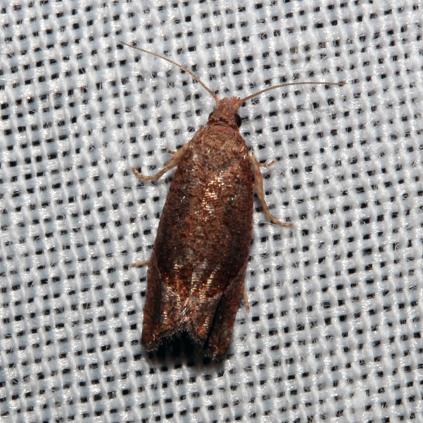
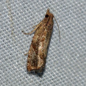
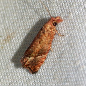
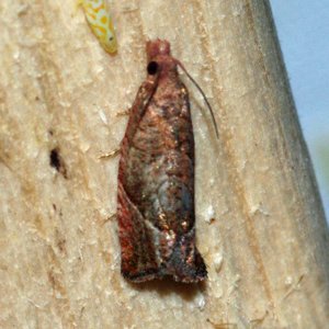
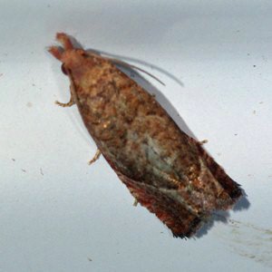
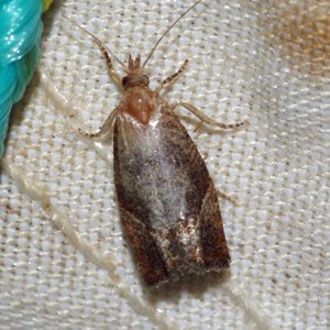
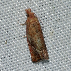
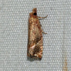
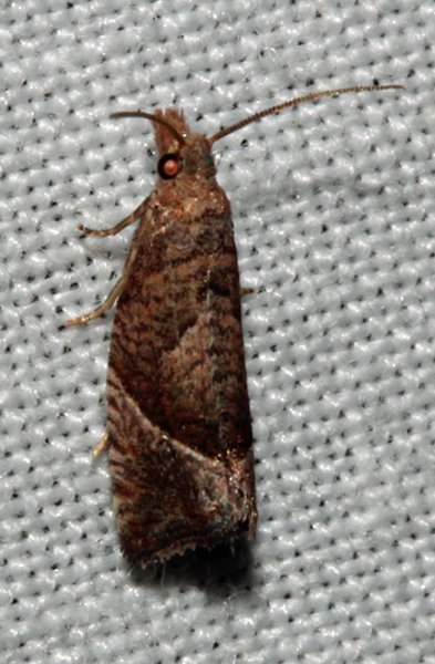
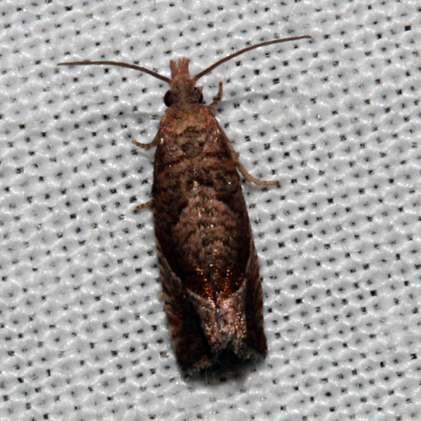
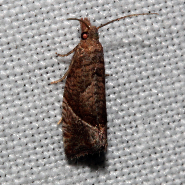
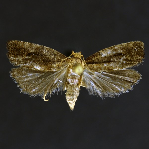
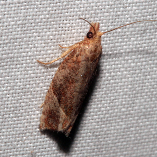
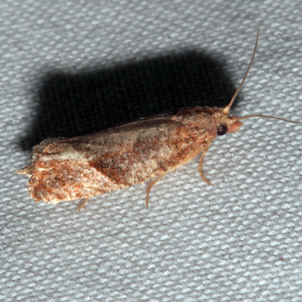
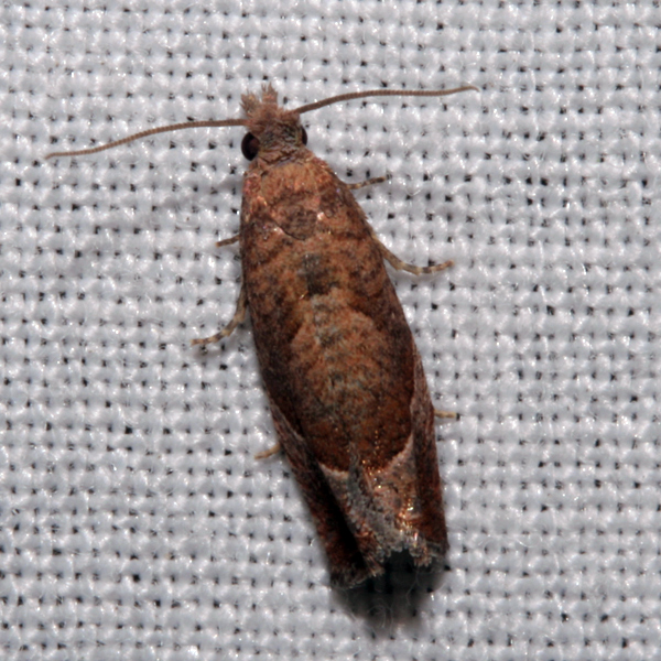
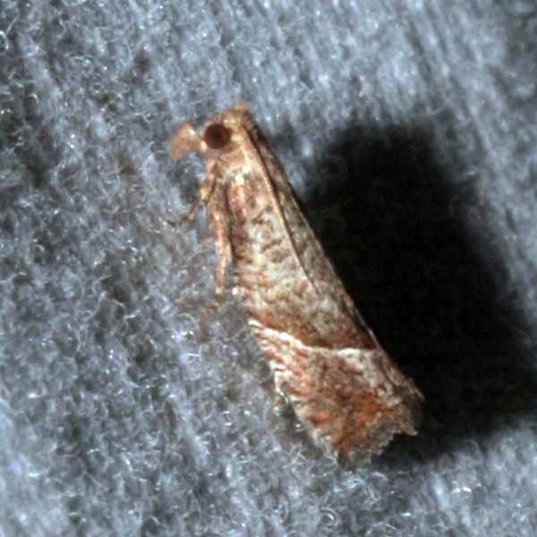
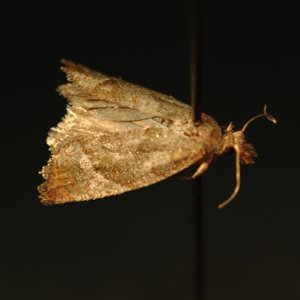
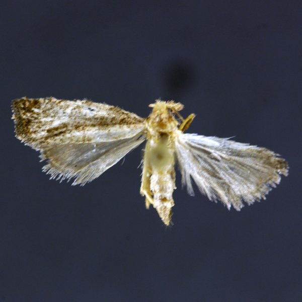
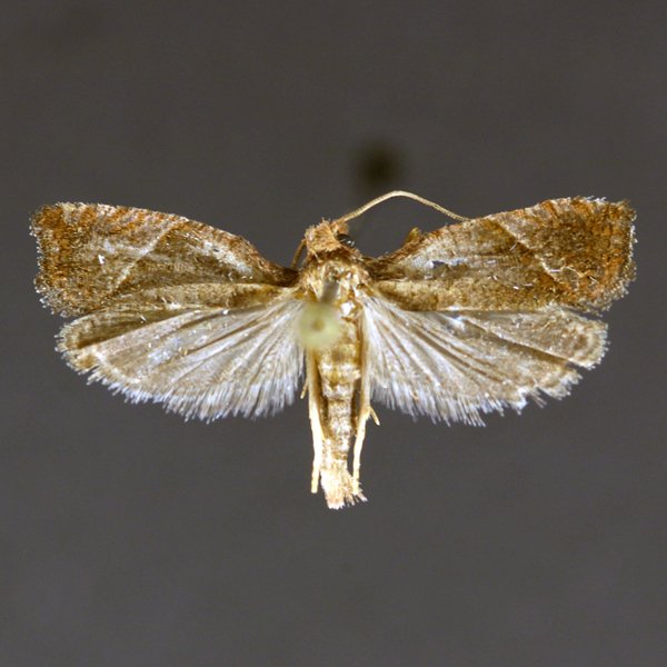
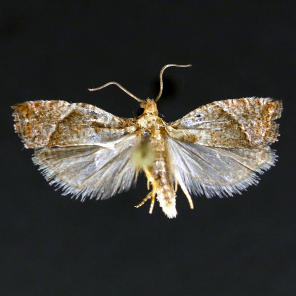
Derelict Eucosma Moth (Pelochrista derelicta), (Heinrich, 1929) - 3120.000000 - 51a0995.1


Photos


Records
| Record # | Date | Locale | State | Lat/Lon | Collected By | Count |
|---|---|---|---|---|---|---|
 341143 341143
|
2023-08-31 | Palisades Kepler State Park | Iowa | 41.90835858 -91.50240348 | Jim Durbin | 1 |
 340746 340746
|
2023-08-28 | Pleasant Creek State Recreation Area, Linn County | Iowa | 42.11016422 -91.82761742 | Jim Durbin | 1 |
 340748 340748
|
2023-08-28 | Pleasant Creek State Recreation Area, Linn County | Iowa | 42.11016422 -91.82761742 | Jim Durbin | 1 |
 348245 348245
|
2023-08-28 | MacBride Nature Recreation Area | Iowa | 41.786616971667 -91.568449623333 | Mark Brown | 1 |
 340929 340929
|
2023-08-25 | Hitaga Sand Ridge Prairie Preserve | Iowa | 42.25093191 -91.63218534 | Jim Durbin | 1 |
 340930 340930
|
2023-08-25 | Hitaga Sand Ridge Prairie Preserve | Iowa | 42.25093191 -91.63218534 | Jim Durbin | 1 |
 340931 340931
|
2023-08-25 | Hitaga Sand Ridge Prairie Preserve | Iowa | 42.25093191 -91.63218534 | Jim Durbin | 1 |
 340971 340971
|
2023-08-25 | Hitaga Sand Ridge Prairie Preserve | Iowa | 42.25093191 -91.63218534 | Jim Durbin | 1 |
 340979 340979
|
2023-08-25 | Hitaga Sand Ridge Prairie Preserve | Iowa | 42.25093191 -91.63218534 | Jim Durbin | 1 |
 347634 347634
|
2023-08-18 | Johnson County, Iowa | Iowa | Location Protected | Mark Brown | 1 |
 339406 339406
|
2023-08-05 | Pleasant Creek State Recreation Area, Linn County | Iowa | 42.11005504 -91.82770624 | Jim Durbin | 1 |
 314082 314082
|
2022-08-30 | F. W. Kent Park | Iowa | 41.73491755 -91.72195511 | Jim Durbin | 1 |
 314131 314131
|
2022-08-30 | F. W. Kent Park | Iowa | 41.73491755 -91.72195511 | Jim Durbin | 1 |
 314357 314357
|
2022-08-30 | F. W. Kent Park | Iowa | 41.73491755 -91.72195511 | Jim Durbin | 1 |
 332098 332098
|
2022-08-28 | Johnson County, Iowa | Iowa | Location Protected | Mark Brown | 1 |
 313711 313711
|
2022-08-25 | Hitaga Sand Ridge Prairie Preserve | Iowa | 42.25103416 -91.63218888 | Jim Durbin | 1 |
 313763 313763
|
2022-08-25 | Hitaga Sand Ridge Prairie Preserve | Iowa | 42.25103416 -91.63218888 | Jim Durbin | 1 |
 332200 332200
|
2022-08-23 | Johnson County, Iowa | Iowa | Location Protected | Mark Brown | 1 |
 313493 313493
|
2022-08-17 | Wanatee County Park | Iowa | 42.01012074 -91.56658753 | Jim Durbin | 1 |
 313498 313498
|
2022-08-17 | Wanatee County Park | Iowa | 42.01012074 -91.56658753 | Jim Durbin | 1 |
 333229 333229
|
2022-08-16 | MacBride Nature Recreation Area | Iowa | 41.78690624833333 -91.56850041333334 | Mark Brown | 1 |
 332871 332871
|
2022-08-13 | MacBride Nature Recreation Area | Iowa | 41.78690624833333 -91.56850041333334 | Mark Brown | 1 |
 332922 332922
|
2022-08-09 | MacBride Nature Recreation Area | Iowa | 41.78690624833333 -91.56850041333334 | Mark Brown | 1 |
 298266 298266
|
2021-08-11 | Johnson County, Iowa | Iowa | Location Protected | Mark Brown | 1 |
 291148 291148
|
2021-08-06 | Hitaga Sand Ridge Prairie Preserve | Iowa | 42.25082292 -91.63215158 | Jim Durbin | 1 |
 291149 291149
|
2021-08-06 | Hitaga Sand Ridge Prairie Preserve | Iowa | 42.25082292 -91.63215158 | Jim Durbin | 1 |
 291172 291172
|
2021-08-06 | Hitaga Sand Ridge Prairie Preserve | Iowa | 42.25082292 -91.63215158 | Jim Durbin | 1 |
 291193 291193
|
2021-08-06 | Hitaga Sand Ridge Prairie Preserve | Iowa | 42.25082292 -91.63215158 | Jim Durbin | 1 |
 291201 291201
|
2021-08-06 | Hitaga Sand Ridge Prairie Preserve | Iowa | 42.25082292 -91.63215158 | Jim Durbin | 1 |
 291308 291308
|
2021-08-06 | Hitaga Sand Ridge Prairie Preserve | Iowa | 42.25082292 -91.63215158 | Jim Durbin | 1 |
 290698 290698
|
2021-07-15 | Matsell Bridge Natural Area | Iowa | 42.13220412 -91.38527708 | Jim Durbin | 1 |
 282279 282279
|
2020-08-14 | Johnson County, Iowa | Iowa | Location Protected | Mark Brown | 1 |
| 356517 | 2019-07-18 | Jewell Prairie | Iowa | 43.320278 -91.826944 | Lena Schmitt | 1 |
 224441 224441
|
2018-08-25 | Hitaga Sand Ridge Prairie Preserve | Iowa | 42.250957 -91.632098 | Jim Durbin | 1 |
| 220036 | 2018-08-20 | MacBride Nature Recreation Area | Iowa | 41.786729 -91.568057 | Mark Brown | 1 |
 219126 219126
|
2018-08-19 | Wickiup Hill Outdoor Learning Area | Iowa | 42.087352 -91.767107 | Jim Durbin | 1 |
 222912 222912
|
2018-08-18 | Ames, Paul | Iowa | 42.02064 -93.623952 | Paul Martsching | 1 |
 218866 218866
|
2018-08-16 | Matsell Bridge Natural Area | Iowa | 42.132148 -91.385221 | Jim Durbin | 1 |
 218882 218882
|
2018-08-16 | Matsell Bridge Natural Area | Iowa | 42.132148 -91.385221 | Jim Durbin | 1 |
 218899 218899
|
2018-08-16 | Matsell Bridge Natural Area | Iowa | 42.132148 -91.385221 | Jim Durbin | 1 |
 225601 225601
|
2018-08-14 | MacBride Nature Recreation Area | Iowa | 41.786729 -91.568057 | Mark Brown | 1 |
 218620 218620
|
2018-08-11 | Hitaga Sand Ridge Prairie Preserve | Iowa | 42.250604 -91.629962 | Jim Durbin | 1 |
 220514 220514
|
2018-08-10 | 100 Acre Wood-x | Iowa | 0 0 | MJ Hatfield | 1 |
 218205 218205
|
2018-08-08 | Hitaga Sand Ridge Prairie Preserve | Iowa | 42.250957 -91.632098 | Jim Durbin | 1 |
 218208 218208
|
2018-08-08 | Hitaga Sand Ridge Prairie Preserve | Iowa | 42.250957 -91.632098 | Jim Durbin | 1 |
 218263 218263
|
2018-08-08 | Hitaga Sand Ridge Prairie Preserve | Iowa | 42.250957 -91.632098 | Jim Durbin | 1 |
| 355432 | 2018-08-08 | Spilde Woods | Iowa | 43.317783 -91.812417 | Lena Schmitt | 1 |
| 356132 | 2018-08-07 | Hickory Ridge Woods | Iowa | 43.3178 -91.7959 | Lena Schmitt | 1 |
 216519 216519
|
2018-07-19 | 100 Acre Wood-x | Iowa | 0 0 | MJ Hatfield | 1 |
| 356518 | 2018-07-18 | Jewell Prairie | Iowa | 43.320278 -91.826944 | Lena Schmitt | 1 |
| 355434 | 2018-07-17 | Spilde Woods | Iowa | 43.317783 -91.812417 | Lena Schmitt | 1 |
| 358750 | 2018-07-17 | Roslien Woods | Iowa | 43.3244 -91.8216 | Lena Schmitt | 1 |
| 355433 | 2018-06-25 | Spilde Woods | Iowa | 43.317783 -91.812417 | Lena Schmitt | 1 |
| 356131 | 2018-06-24 | Hickory Ridge Woods | Iowa | 43.3178 -91.7959 | Lena Schmitt | 1 |
| 356519 | 2018-06-24 | Jewell Prairie | Iowa | 43.320278 -91.826944 | Lena Schmitt | 1 |
| 358751 | 2018-06-24 | Roslien Woods | Iowa | 43.3244 -91.8216 | Lena Schmitt | 1 |
 196188 196188
|
2017-08-30 | Hitaga Sand Ridge Prairie Preserve | Iowa | 42.250957 -91.632098 | Jim Durbin | 1 |
 195427 195427
|
2017-08-14 | Hitaga Sand Ridge Prairie Preserve | Iowa | 42.250957 -91.632098 | Jim Durbin | 1 |
 195434 195434
|
2017-08-14 | Hitaga Sand Ridge Prairie Preserve | Iowa | 42.250957 -91.632098 | Jim Durbin | 1 |
 195435 195435
|
2017-08-14 | Hitaga Sand Ridge Prairie Preserve | Iowa | 42.250957 -91.632098 | Jim Durbin | 1 |
 194791 194791
|
2017-08-01 | Matsell Bridge Natural Area | Iowa | 42.131126 -91.388999 | Jim Durbin | 1 |
 194596 194596
|
2017-07-29 | Hitaga Sand Ridge Prairie Preserve | Iowa | 42.250957 -91.632098 | Jim Durbin | 1 |
 194618 194618
|
2017-07-29 | Hitaga Sand Ridge Prairie Preserve | Iowa | 42.250957 -91.632098 | Jim Durbin | 1 |
 208091 208091
|
2017-07-20 | 100 Acre Wood-x | Iowa | 0 0 | MJ Hatfield | 1 |
 174831 174831
|
2016-08-21 | Hitaga Sand Ridge Prairie Preserve | Iowa | 42.250957 -91.632098 | Jim Durbin | 1 |
| 180249 | 2016-08-14 | Algona | Iowa | 43.06998 -94.23295 | Matt Kenne | 1 |
| 264245 | 2016-08-14 | Algona | Iowa | 43.06998 -94.23295 | Matt Kenne | 1 |
 174028 174028
|
2016-08-09 | Hitaga Sand Ridge Prairie Preserve | Iowa | 42.250957 -91.632098 | Jim Durbin | 1 |
 174125 174125
|
2016-08-09 | Hitaga Sand Ridge Prairie Preserve | Iowa | 42.250957 -91.632098 | Jim Durbin | 1 |
 65172 65172
|
2014-08-30 | Pleasant Creek State Recreation Area, Linn County | Iowa | 42.110327 -91.822988 | Jim Durbin | 1 |
 50112 50112
|
2014-08-18 | Wanatee County Park | Iowa | 42.01007 -91.566739 | Jim Durbin | 1 |
 50128 50128
|
2014-08-18 | Wanatee County Park | Iowa | 42.01007 -91.566739 | Jim Durbin | 1 |
 10770 10770
|
2014-08-08 | Pleasant Creek State Recreation Area, Linn County | Iowa | 42.110327 -91.822988 | Jim Durbin | 1 |
 10805 10805
|
2014-08-08 | Pleasant Creek State Recreation Area, Linn County | Iowa | 42.110327 -91.822988 | Jim Durbin | 1 |
 10488 10488
|
2014-08-05 | Hitaga Sand Ridge Prairie Preserve | Iowa | 42.24944 -91.63056 | Jim Durbin | 1 |
 10491 10491
|
2014-08-05 | Hitaga Sand Ridge Prairie Preserve | Iowa | 42.24944 -91.63056 | Jim Durbin | 1 |
 10501 10501
|
2014-08-05 | Hitaga Sand Ridge Prairie Preserve | Iowa | 42.24944 -91.63056 | Jim Durbin | 1 |
 10503 10503
|
2014-08-05 | Hitaga Sand Ridge Prairie Preserve | Iowa | 42.24944 -91.63056 | Jim Durbin | 1 |
 66326 66326
|
2013-08-26 | Near Fairfield | Iowa | 41.0503 -92.024 | Moni Hayne | 1 |
 26286 26286
|
2013-08-24 | Pinicon Ridge Park | Iowa | 42.21028 -91.54417 | Jim Durbin | 1 |
 26285 26285
|
2013-08-21 | Matsell Bridge Natural Area | Iowa | 42.13131 -91.38886 | Jim Durbin | 1 |
 66314 66314
|
2013-08-21 | Near Fairfield | Iowa | 41.0503 -92.024 | Moni Hayne | 1 |
 26287 26287
|
2012-08-27 | Near Fairfield | Iowa | 41.0503 -92.024 | Moni Hayne | 1 |
 26283 26283
|
2012-08-25 | Iowa City | Iowa | 41.667 -91.545 | Mark Brown | 1 |
 26281 26281
|
2012-08-18 | Matsell Bridge Natural Area | Iowa | 42.13131 -91.38886 | Jim Durbin | 1 |
 26282 26282
|
2012-08-18 | Matsell Bridge Natural Area | Iowa | 42.13131 -91.38886 | Jim Durbin | 1 |
 146110 146110
|
2012-08-15 | Plymouth Rock-x | Iowa | 0 0 | MJ Hatfield | 1 |
 66498 66498
|
2012-08-14 | 100 Acre Wood-x | Iowa | 0 0 | MJ Hatfield | 1 |
 66828 66828
|
2012-08-14 | 100 Acre Wood-x | Iowa | 0 0 | MJ Hatfield | 1 |
 26279 26279
|
2012-07-22 | Wakpicada Natural Area | Iowa | 42.18892 -91.52035 | Jim Durbin | 1 |
 26274 26274
|
2012-07-19 | Wanatee County Park | Iowa | 42.01026 -91.57381 | Jim Durbin | 1 |
 26275 26275
|
2012-07-19 | Wanatee County Park | Iowa | 42.01026 -91.57381 | Jim Durbin | 1 |
 26276 26276
|
2012-07-19 | Wanatee County Park | Iowa | 42.01026 -91.57381 | Jim Durbin | 1 |
 26277 26277
|
2012-07-19 | Wanatee County Park | Iowa | 42.01026 -91.57381 | Jim Durbin | 1 |
 26278 26278
|
2012-07-19 | Wanatee County Park | Iowa | 42.01026 -91.57381 | Jim Durbin | 1 |
 26273 26273
|
2012-07-16 | Matsell Bridge Natural Area | Iowa | 42.13131 -91.38886 | Jim Durbin | 1 |
 26284 26284
|
2012-07-10 | 100 Acre Wood-x | Iowa | 0 0 | MJ Hatfield | 1 |
 66496 66496
|
2012-07-10 | 100 Acre Wood-x | Iowa | 0 0 | MJ Hatfield | 1 |
 66497 66497
|
2012-07-10 | 100 Acre Wood-x | Iowa | 0 0 | MJ Hatfield | 1 |
 26272 26272
|
2012-07-08 | Wanatee County Park | Iowa | 42.0094 -91.56623 | Jim Durbin | 1 |
 26269 26269
|
2011-08-19 | Wanatee County Park | Iowa | 42.0094 -91.56623 | Jim Durbin | 1 |
 66799 66799
|
2011-08-16 | 100 Acre Wood-x | Iowa | 0 0 | MJ Hatfield | 1 |
 66802 66802
|
2011-08-16 | 100 Acre Wood-x | Iowa | 0 0 | MJ Hatfield | 1 |
 26268 26268
|
2011-08-10 | Leon's Farm, Ohio County | Kentucky | 37.42033 -86.77023 | Jim Durbin | 1 |
 66968 66968
|
2011-07-25 | 100 Acre Wood-x | Iowa | 0 0 | MJ Hatfield | 1 |
 66999 66999
|
2011-07-20 | 100 Acre Wood-x | Iowa | 0 0 | MJ Hatfield | 1 |
| 26270 | 2011-05-18 | Puccoon Prairie | Iowa | 41.73528 -93.36417 | Keith Summerville | 1 |
| 26271 | 2011-05-18 | Chichaqua Bottoms Sandhill Prairie | Iowa | 41.77278 -93.385 | Keith Summerville | 1 |
 26264 26264
|
2010-08-06 | Lost Island County Park | Iowa | 43.17582 -94.89189 | Jim Durbin | 1 |
 26265 26265
|
2010-08-06 | Lost Island County Park | Iowa | 43.17582 -94.89189 | Jim Durbin | 1 |
 26266 26266
|
2010-08-06 | Lost Island County Park | Iowa | 43.17582 -94.89189 | Jim Durbin | 1 |
 26267 26267
|
2010-07-15 | 100 Acre Wood-x | Iowa | 0 0 | MJ Hatfield | 1 |
 26263 26263
|
2008-08-15 | Wickiup Hill Outdoor Learning Area | Iowa | 42.08398 -91.7651 | Jim Durbin | 1 |
 26262 26262
|
2008-08-11 | Linn County, Iowa | Iowa | Location Protected | Jim Durbin | 1 |
| 70000 | 2006-05-25 | Big Creek State Park | Iowa | 41.807055 -93.745185 | Keith Summerville | 14 |
| 70009 | 2006-05-25 | Chichaqua Bottoms Sandhill Prairie | Iowa | 41.77278 -93.385 | Keith Summerville | 18 |
| 70011 | 2006-05-25 | Paul Errington Marsh Wildlife Management Area | Iowa | 41.75611 -93.50556 | Keith Summerville | 9 |
| 70013 | 2006-05-25 | Glendale Cemetery | Iowa | 41.60889 -93.69167 | Keith Summerville | 4 |
| 70016 | 2006-05-25 | Neal Smith National Wildlife Refuge | Iowa | 41.57639 -93.265 | Keith Summerville | 38 |
| 70019 | 2006-05-25 | Big Creek State Park | Iowa | 41.81167 -93.75333 | Keith Summerville | 8 |
| 70022 | 2006-05-25 | Yellow Banks Park | Iowa | 41.547615 -93.47527 | Keith Summerville | 6 |
| 26260 | 2005-05-25 | Neal Smith National Wildlife Refuge | Iowa | 41.54245 -93.2908 | Keith Summerville | 1 |
| 69999 | 2005-05-25 | Big Creek State Park | Iowa | 41.807055 -93.745185 | Keith Summerville | 9 |
| 70002 | 2005-05-25 | Thomas Mitchell Park | Iowa | 41.64 -93.3823 | Keith Summerville | 1 |
| 70004 | 2005-05-25 | Puccoon Prairie | Iowa | 41.73528 -93.36417 | Keith Summerville | 7 |
| 70006 | 2005-05-25 | Synder Farm INHF | Iowa | 41.76675 -93.484171 | Keith Summerville | 12 |
| 70008 | 2005-05-25 | Chichaqua Bottoms Sandhill Prairie | Iowa | 41.77278 -93.385 | Keith Summerville | 2 |
| 70010 | 2005-05-25 | Paul Errington Marsh Wildlife Management Area | Iowa | 41.75611 -93.50556 | Keith Summerville | 8 |
| 70012 | 2005-05-25 | Glendale Cemetery | Iowa | 41.60889 -93.69167 | Keith Summerville | 1 |
| 70015 | 2005-05-25 | Neal Smith National Wildlife Refuge | Iowa | 41.57639 -93.265 | Keith Summerville | 3 |
| 70018 | 2005-05-25 | Big Creek State Park | Iowa | 41.81167 -93.75333 | Keith Summerville | 6 |
| 70021 | 2005-05-25 | Yellow Banks Park | Iowa | 41.547615 -93.47527 | Keith Summerville | 7 |
| 70023 | 2005-05-25 | Neal Smith National Wildlife Refuge | Iowa | 41.54245 -93.2908 | Keith Summerville | 10 |
| 26261 | 2004-05-25 | Neal Smith National Wildlife Refuge | Iowa | 41.57639 -93.265 | Keith Summerville | 1 |
| 69998 | 2004-05-25 | Big Creek State Park | Iowa | 41.807055 -93.745185 | Keith Summerville | 14 |
| 70001 | 2004-05-25 | Thomas Mitchell Park | Iowa | 41.64 -93.3823 | Keith Summerville | 2 |
| 70003 | 2004-05-25 | Puccoon Prairie | Iowa | 41.73528 -93.36417 | Keith Summerville | 2 |
| 70005 | 2004-05-25 | Synder Farm INHF | Iowa | 41.76675 -93.484171 | Keith Summerville | 2 |
| 70007 | 2004-05-25 | Chichaqua Bottoms Sandhill Prairie | Iowa | 41.77278 -93.385 | Keith Summerville | 4 |
| 70014 | 2004-05-25 | Neal Smith National Wildlife Refuge | Iowa | 41.57639 -93.265 | Keith Summerville | 4 |
| 70017 | 2004-05-25 | Big Creek State Park | Iowa | 41.81167 -93.75333 | Keith Summerville | 3 |
| 70020 | 2004-05-25 | Yellow Banks Park | Iowa | 41.547615 -93.47527 | Keith Summerville | 7 |
| 26259 | 2003-05-15 | Neal Smith National Wildlife Refuge | Iowa | 41.5678 -93.2675 | Keith Summerville | 1 |
| 227588 | 1995-08-01 | Loess Hills Wildlife Management Area | Iowa | 42.12222 -95.95667 | Donald Wright | 1 |