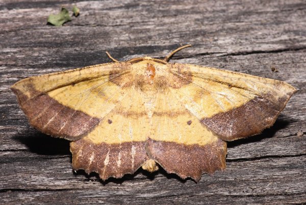
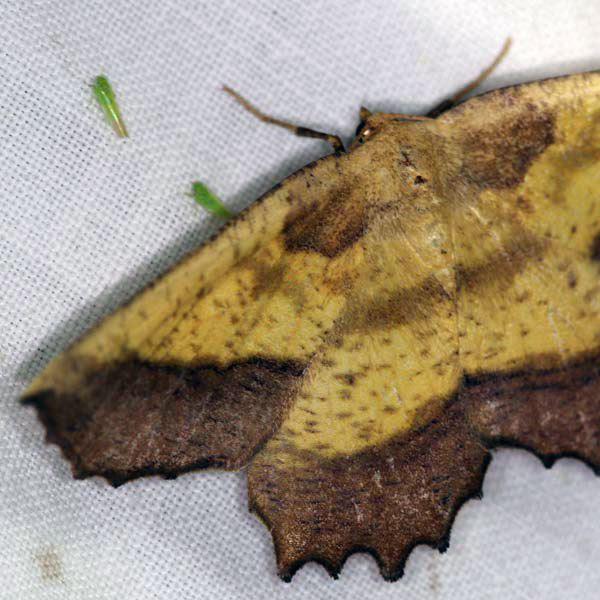
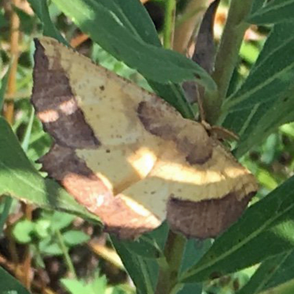
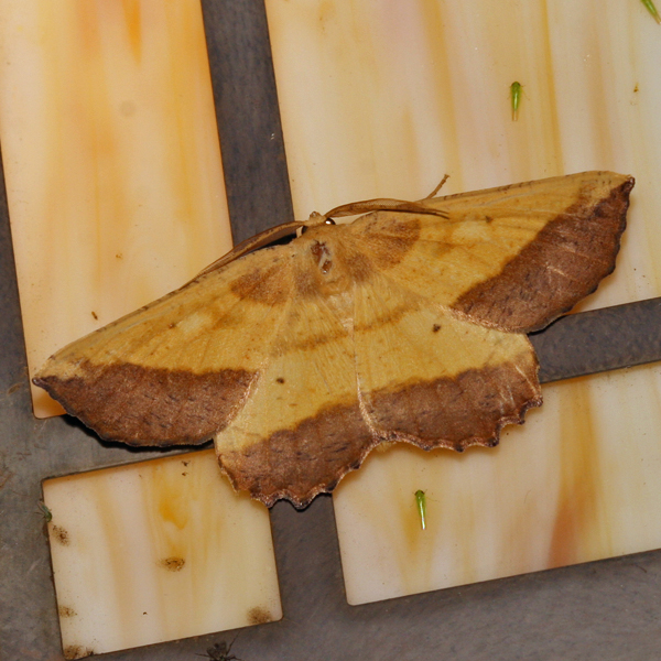
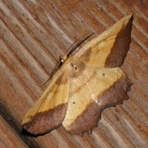
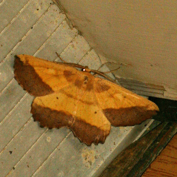
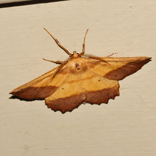
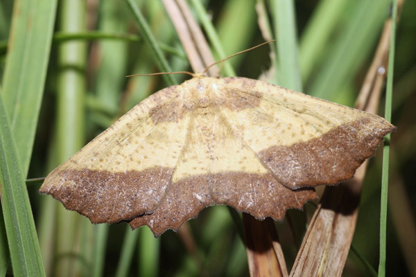
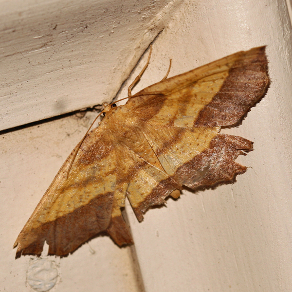
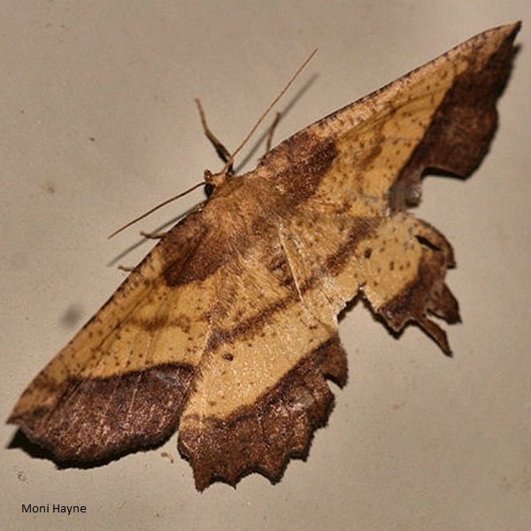
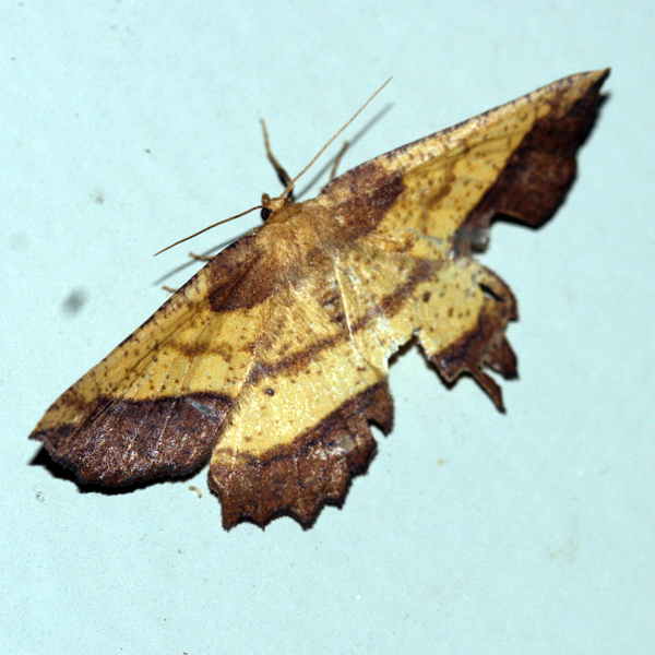
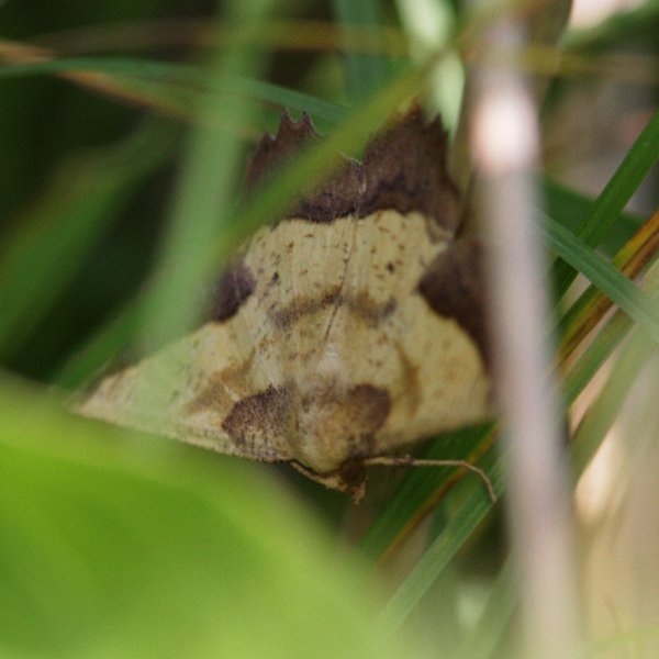
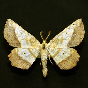
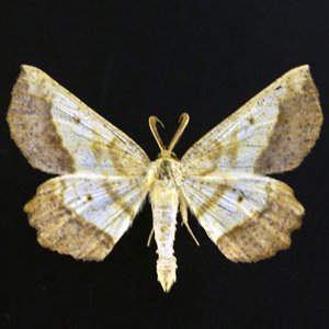
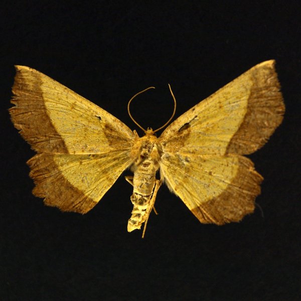
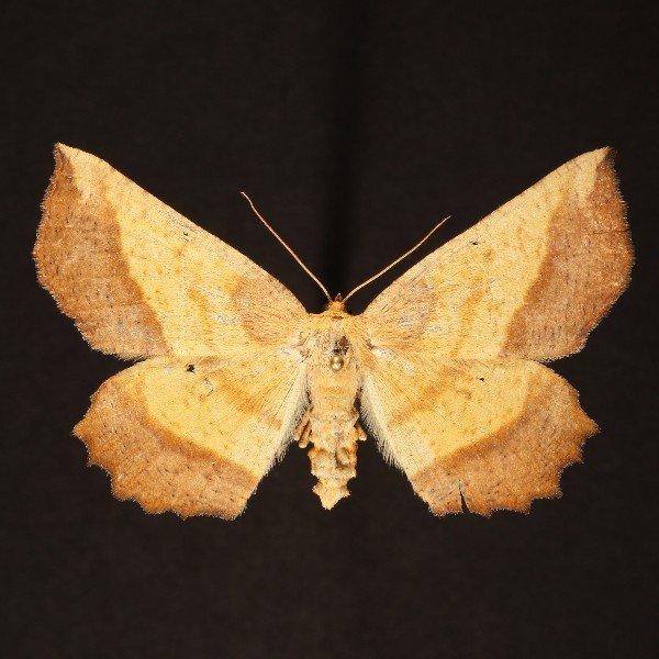
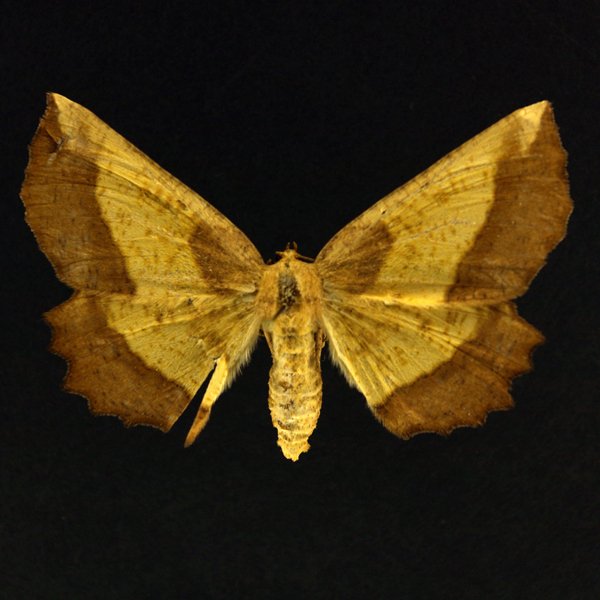
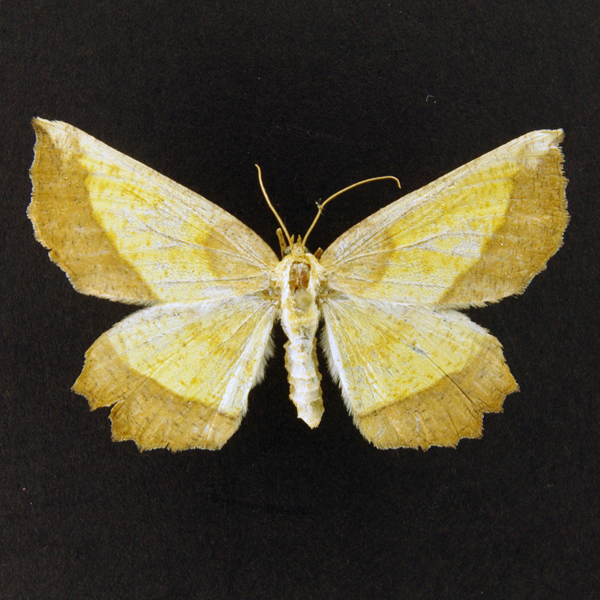
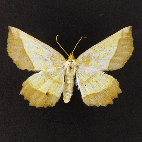
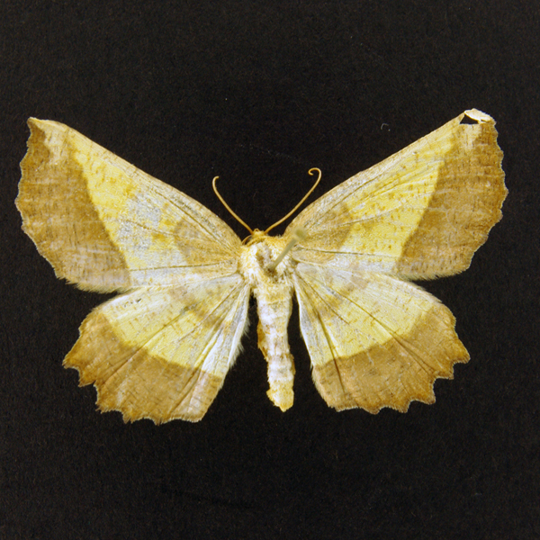
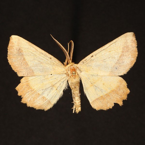
The Saw Wing (Euchlaena serrata), (Drury, 1773) - 6724.000000 - 91a1204
Wing span: 47mm
Flight time: May - July


Photos


Records
| Record # | Date | Locale | State | Lat/Lon | Collected By | Count |
|---|---|---|---|---|---|---|
 232917 232917
|
2019-06-29 | Wickiup Hill Outdoor Learning Area | Iowa | 42.0876 -91.76787 | Jim Durbin | 1 |
 216072 216072
|
2018-07-04 | Lake Sugema Wildlife Area | Iowa | 40.688857 -92.013429 | Aaron Brees | 1 |
 224500 224500
|
2018-06-23 | Sundown Lake Recreation Area | Iowa | 40.830089 -92.747939 | Eric Liskey | 1 |
 209207 209207
|
2016-06-13 | Near Fairfield | Iowa | 41.0503 -92.024 | Moni Hayne | 1 |
 209208 209208
|
2016-06-13 | Near Fairfield | Iowa | 41.0503 -92.024 | Moni Hayne | 1 |
 209209 209209
|
2016-06-13 | Near Fairfield | Iowa | 41.0503 -92.024 | Moni Hayne | 1 |
 209210 209210
|
2016-06-13 | Near Fairfield | Iowa | 41.0503 -92.024 | Moni Hayne | 1 |
 133261 133261
|
2015-07-13 | Grand River Grasslands / Kellerton Bird Conservation Area | Iowa | 40.657259 -94.110879 | Logan Crees | 1 |
 130275 130275
|
2015-06-18 | Grand River Grasslands / Kellerton Bird Conservation Area | Iowa | 40.657259 -94.110879 | Logan Crees | 1 |
 120670 120670
|
2014-07-07 | Near Fairfield | Iowa | 41.0503 -92.024 | Moni Hayne | 1 |
 26190 26190
|
2013-07-04 | Near Fairfield | Iowa | 41.0503 -92.024 | Moni Hayne | 1 |
 66213 66213
|
2013-07-04 | Near Fairfield | Iowa | 41.0503 -92.024 | Moni Hayne | 1 |
 26186 26186
|
2011-07-09 | Black Hawk Point Wildlife Management Area | Iowa | 43.4602778 -91.2980555 | Frank Olsen | 1 |
 26185 26185
|
2011-06-26 | Slip Bluff County Park | Iowa | 40.65255 -93.84534 | Aaron Brees | 1 |
| 26187 | 2011-05-18 | Puccoon Prairie | Iowa | 41.73528 -93.36417 | Keith Summerville | 1 |
| 26188 | 2011-05-18 | Chichaqua Bottoms Sandhill Prairie | Iowa | 41.77278 -93.385 | Keith Summerville | 1 |
 26182 26182
|
2009-07-14 | Anderson Prairie, Decorah | Iowa | 43.315099 -91.800701 | Reese Worthington | 1 |
 26184 26184
|
2009-07-14 | Anderson Prairie, Decorah | Iowa | 43.315099 -91.800701 | Reese Worthington | 1 |
| 354139 | 2009-06-26 | Chipera Prairie Park | Iowa | 43.1325 -92.0075 | Peter Kraus | 1 |
 26181 26181
|
2006-07-02 | Wanatee County Park | Iowa | 42.0094 -91.56623 | Jim Durbin | 1 |
| 69947 | 2006-05-25 | Chichaqua Bottoms Sandhill Prairie | Iowa | 41.77278 -93.385 | Keith Summerville | 1 |
 26178 26178
|
2005-07-08 | Pleasant Creek State Recreation Area, Linn County | Iowa | 42.11952 -91.81215 | Jim Durbin | 1 |
| 203280 | 2005-07-03 | Ames, Paul | Iowa | 42.02064 -93.62395 | Paul Martsching | 1 |
 26180 26180
|
2005-06-29 | Rock Island Botanical State Preserve | Iowa | 42.02732 -91.72723 | Frank Olsen | 1 |
 26179 26179
|
2005-06-01 | Fire Station No 3, Ames | Iowa | 42.00117 -93.6093 | Jeff Westphal | 1 |
| 69946 | 2005-05-25 | Big Creek State Park | Iowa | 41.807055 -93.745185 | Keith Summerville | 2 |
| 69948 | 2005-05-25 | Big Creek State Park | Iowa | 41.81167 -93.75333 | Keith Summerville | 1 |
 26175 26175
|
2004-06-29 | Cayler Prairie State Preserve | Iowa | 43.3972 -95.2459 | Frank Olsen | 1 |
 26173 26173
|
2004-06-23 | Pleasant Creek State Recreation Area, Linn County | Iowa | 42.11952 -91.81215 | Jim Durbin | 1 |
| 26172 | 2003-07-26 | Wanatee County Park | Iowa | 42.0094 -91.56623 | Jim Durbin | 1 |
| 203279 | 2003-07-25 | Ames, Paul | Iowa | 42.02064 -93.62395 | Paul Martsching | 2 |
| 26163 | 2003-07-14 | Wanatee County Park | Iowa | 42.0094 -91.56623 | Jim Durbin | 1 |
 26174 26174
|
2003-06-27 | Rock Island Botanical State Preserve | Iowa | 42.02732 -91.72723 | Frank Olsen | 1 |
 133868 133868
|
2003-06-21 | Ames, Paul | Iowa | 42.02064 -93.623952 | Paul Martsching | 1 |
| 26177 | 2003-05-15 | Neal Smith National Wildlife Refuge | Iowa | 41.5678 -93.2675 | Keith Summerville | 1 |
 133867 133867
|
2002-07-03 | Ames, Paul | Iowa | 42.02064 -93.623952 | Paul Martsching | 1 |
 133866 133866
|
2002-06-28 | Ames, Paul | Iowa | 42.02064 -93.623952 | Paul Martsching | 1 |
 26189 26189
|
2002-06-27 | Prairie Ridge Park | Iowa | 40.87333 -92.88983 | Dennis Schlicht | 1 |
| 203278 | 2002-06-23 | Ames, Paul | Iowa | 42.02064 -93.62395 | Paul Martsching | 3 |
 26176 26176
|
1993-07-10 | Riverside Bluff | Iowa | 42.5126 -96.47105 | Tim Orwig | 1 |