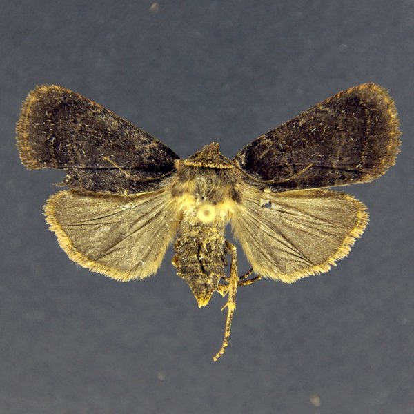
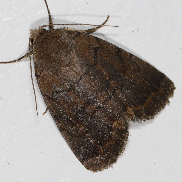
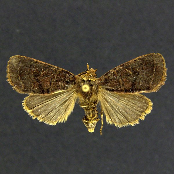
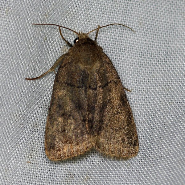
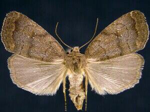
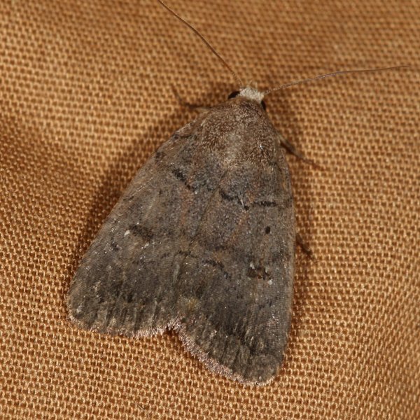
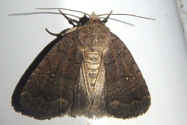
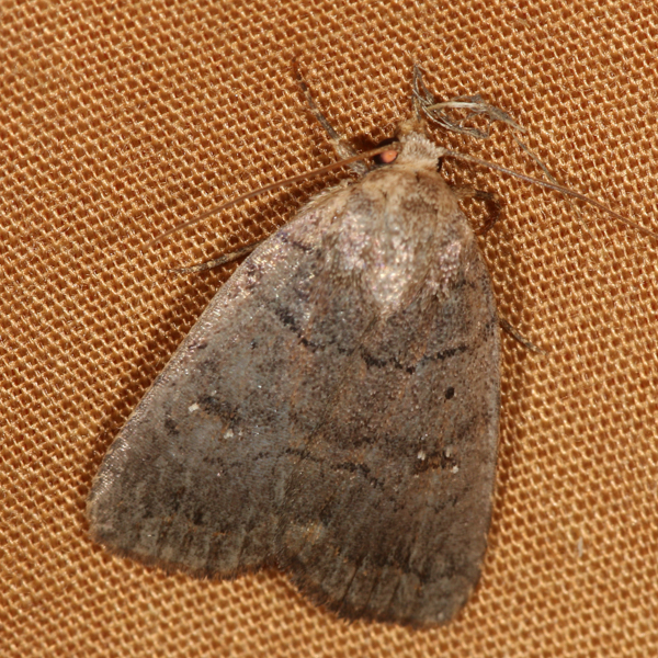
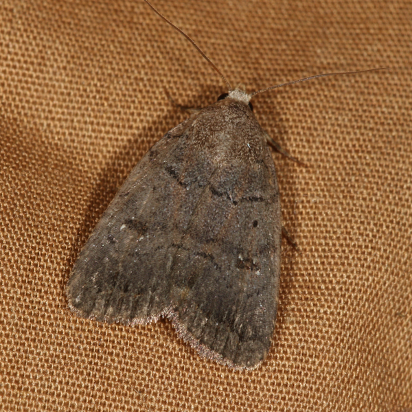
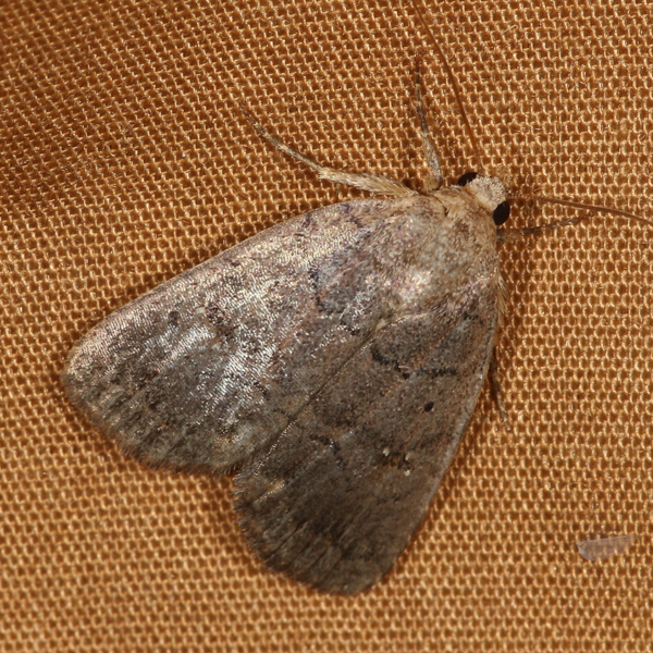
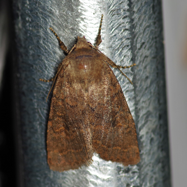
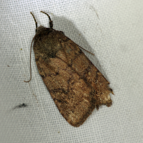
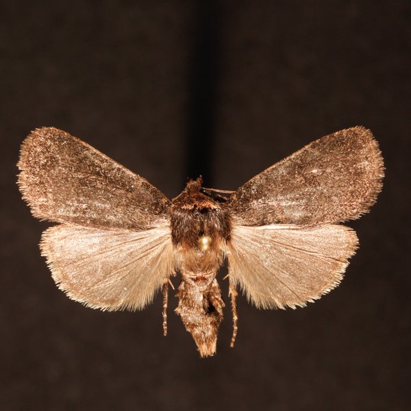
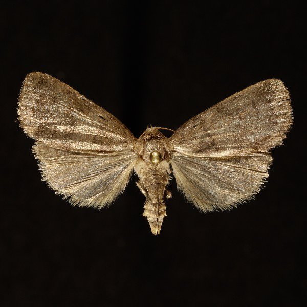
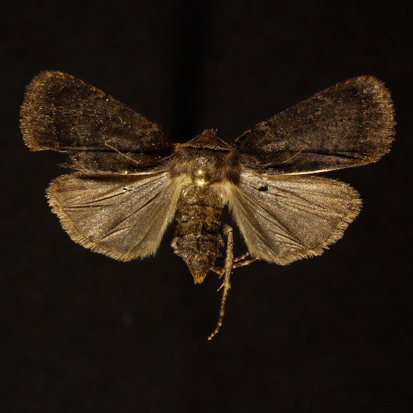
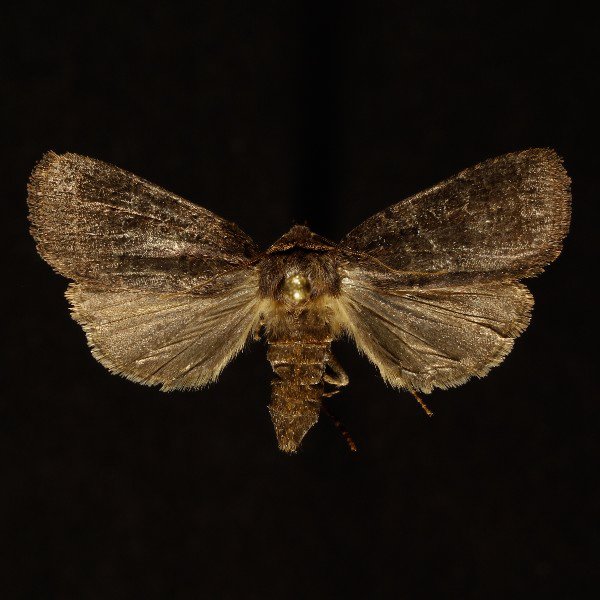
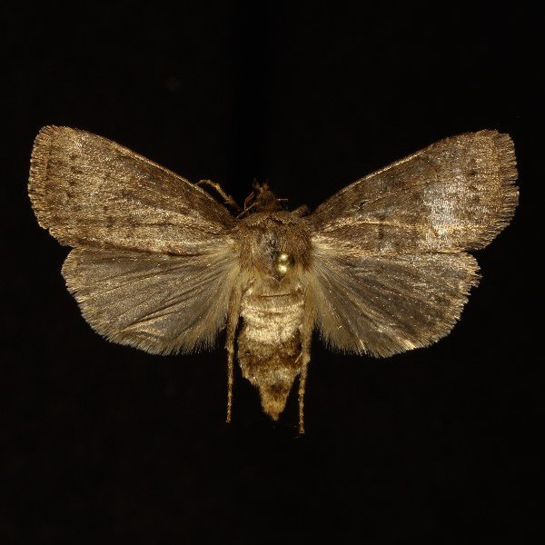
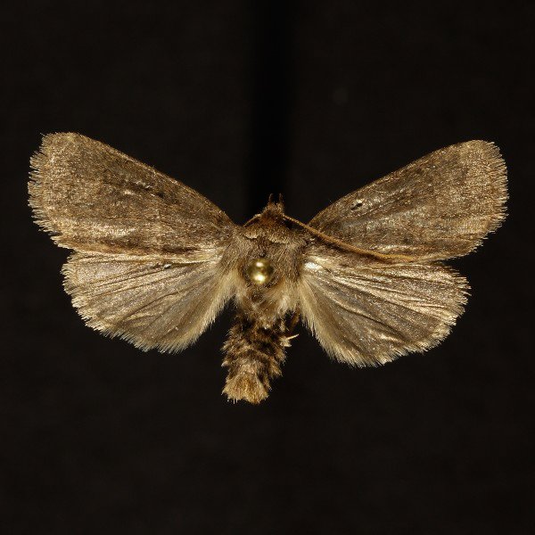
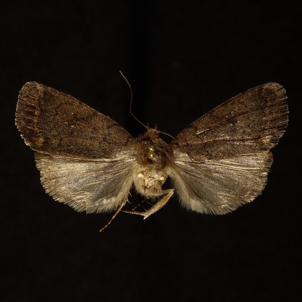
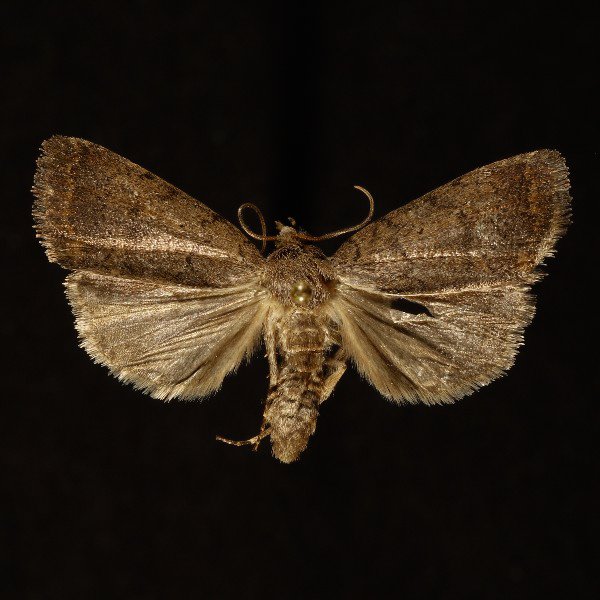
The Slow Poke (Athetis tarda), (Guenee, 1852) - 9650.000000 - 932269
Wing span: 29mm
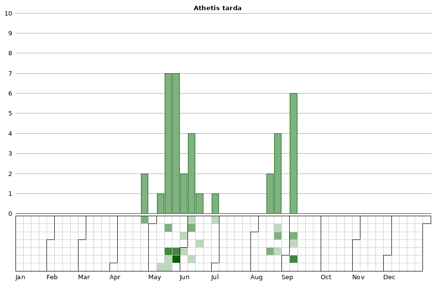
Flight time: May - August
Photos
Records
| Record # | Date | Locale | State | Lat/Lon | Collected By | Count |
|---|---|---|---|---|---|---|
 348647 348647
|
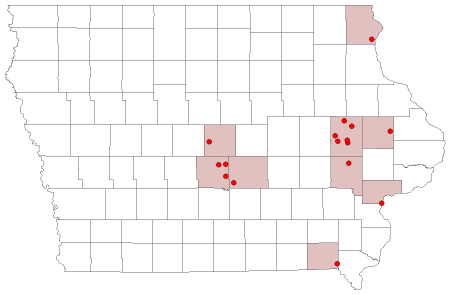
2023-08-24 | Johnson County, Iowa | Iowa | Location Protected | Mark Brown | 1 |
 339936 339936
|
2023-08-17 | Big Sand Mound Prairie Preserve, Muscatine County | Iowa | 41.34031372 -91.0810559 | Jim Durbin | 1 |
 339939 339939
|
2023-08-17 | Big Sand Mound Prairie Preserve, Muscatine County | Iowa | 41.34031372 -91.0810559 | Jim Durbin | 1 |
 290193 290193
|
2021-05-20 | MacBride Nature Recreation Area | Iowa | 41.787057 -91.568305 | Mark Brown | 1 |
 238137 238137
|
2019-09-05 | Wickiup Hill Outdoor Learning Area | Iowa | 42.087352 -91.767107 | Jim Durbin | 1 |
 238145 238145
|
2019-09-05 | Wickiup Hill Outdoor Learning Area | Iowa | 42.087352 -91.767107 | Jim Durbin | 1 |
 219723 219723
|
2018-09-08 | Wickiup Hill Outdoor Learning Area | Iowa | 42.087352 -91.767107 | Jim Durbin | 1 |
 219748 219748
|
2018-09-08 | Wickiup Hill Outdoor Learning Area | Iowa | 42.087352 -91.767107 | Jim Durbin | 1 |
 219787 219787
|
2018-09-08 | Wickiup Hill Outdoor Learning Area | Iowa | 42.087352 -91.767107 | Jim Durbin | 1 |
 176223 176223
|
2016-09-05 | Hitaga Sand Ridge Prairie Preserve | Iowa | 42.250957 -91.632098 | Jim Durbin | 1 |
 168040 168040
|
2016-05-31 | Hitaga Sand Ridge Prairie Preserve | Iowa | 42.250957 -91.632098 | Jim Durbin | 1 |
 225046 225046
|
2014-06-09 | 1460 Douglas Ct, Marion | Iowa | 42.040069 -91.590953 | Jim Durbin | 1 |
| 111562 | 2013-08-21 | Polk County, Iowa | Iowa | Location Protected | Aaron Brees | 1 |
 44253 44253
|
2012-05-12 | Westphal Timber, Jones | Iowa | 42.1349 -90.95348 | Jim Durbin | 1 |
 17168 17168
|
2011-06-05 | Shimek State Forest, Farmington Unit | Iowa | 40.6659 -91.73637 | Jim Durbin | 1 |
 17169 17169
|
2011-06-05 | Shimek State Forest, Farmington Unit | Iowa | 40.6659 -91.73637 | Jim Durbin | 1 |
 17170 17170
|
2011-06-04 | Rock Island Botanical State Preserve | Iowa | 42.02732 -91.72723 | Tom Jantscher | 1 |
 17171 17171
|
2011-05-30 | Rock Island Botanical State Preserve | Iowa | 42.02732 -91.72723 | Tom Jantscher | 1 |
| 17172 | 2011-05-18 | Chichaqua Bottoms Sandhill Prairie | Iowa | 41.77278 -93.385 | Keith Summerville | 1 |
| 17173 | 2011-05-18 | Polk County, Iowa | Iowa | Location Protected | Keith Summerville | 1 |
| 17174 | 2011-05-18 | Chichaqua Bottoms Sandhill Prairie | Iowa | 41.77167 -93.38361 | Keith Summerville | 1 |
 17165 17165
|
2010-06-25 | Yellow River State Forest | Iowa | 43.13753 -91.22503 | Jim Durbin | 1 |
 17166 17166
|
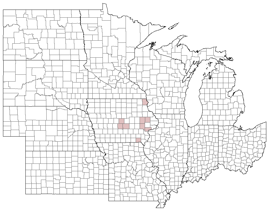
2010-06-14 | Babcock State Park | West Virginia | 38.00821 -80.94937 | Jim Durbin | 1 |
 17164 17164
|
2010-05-15 | Wanatee County Park | Iowa | 42.00994 -91.57749 | Jim Durbin | 1 |
 17162 17162
|
2010-04-23 | Leon's Farm, Ohio County | Kentucky | 37.42033 -86.77023 | Jim Durbin | 1 |
 17163 17163
|
2010-04-23 | Leon's Farm, Ohio County | Kentucky | 37.42033 -86.77023 | Jim Durbin | 1 |
 17161 17161
|
2007-05-19 | Wakpicada Natural Area | Iowa | 42.18892 -91.52035 | Jim Durbin | 1 |
 136961 136961
|
2006-08-22 | Ames, Paul | Iowa | 42.02064 -93.623952 | Paul Martsching | 1 |
| 206565 | 2006-08-22 | Ames, Paul | Iowa | 42.02064 -93.623952 | Paul Martsching | 1 |
| 206564 | 2006-05-26 | Ames, Paul | Iowa | 42.02064 -93.623952 | Paul Martsching | 3 |
| 69311 | 2006-05-25 | Chichaqua Bottoms Sandhill Prairie | Iowa | 41.77278 -93.385 | Keith Summerville | 1 |
| 69309 | 2005-05-25 | Thomas Mitchell Park | Iowa | 41.64 -93.3823 | Keith Summerville | 2 |
| 69310 | 2004-05-25 | Synder Farm INHF | Iowa | 41.76675 -93.484171 | Keith Summerville | 1 |
| 17160 | 2003-05-15 | Neal Smith National Wildlife Refuge | Iowa | 41.5678 -93.2675 | Keith Summerville | 1 |